

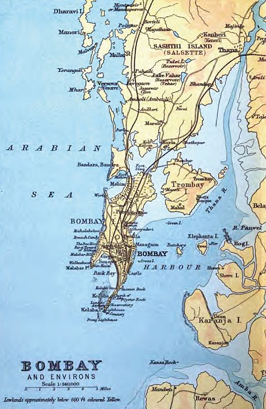
Map of Bombay (1909) showing Cumballa Hill
Island of Bombay (map)
- Date
- 1909
- Mapmaker / publisher
- J.G. Bartholomew, The Edinburgh Geographical Institute
- Place
- Mumbai
- Archive
- Wikimedia Commons
- Type
- map
- Original size
- 545 × 515 pixels
Public domain
Reason: its maker died long enough ago that the copyright has expired.
This status rests on the map's publication history, as researched by Wikimedia Commons. Check it before commercial use.
Read from: Commons licence category: PD Old; no CC BY, CC BY-SA, GFDL or deletion tag on the file page.
Credit line
"Map of Bombay (1909) showing Cumballa Hill" (1909). J.G. Bartholomew, The Edinburgh Geographical Institute, via Wikimedia Commons. Public domain. https://commons.wikimedia.org/wiki/File:Map_of_Bombay_(1909)_showing_Cumballa_Hill.pngNeed maps for a whole project? Add Find Any Map to Claude and ask for this one by its id: 255891.
More like this

Bombay 1909
1909 · Wikimedia Commons

Map of the Island of Bombay from The Imperial Gazetteer of India (1907-1909)
1907–1909 · Wikimedia Commons

Bombay 1903
1903 · Wikimedia Commons

Map of the City of Bombay from The Imperial Gazetteer of India (1907-1909)
1907–1909 · Wikimedia Commons

Bombay Island map 1893
1893 · Wikimedia Commons

Bombay City map
1893 · Wikimedia Commons
This is an 1893 map of the original islands of Bombay before they were merged to form the present-day geographic entity.
1893 · Wikimedia Commons

Bombay 1924
1924 · Wikimedia Commons