

Map of Africa to illustrate the progress of surveys and explorations
WWI map from the collections of the National Library of Wales
- Date
- 1919
- Place
- Africa
- Archive
- Wikimedia Commons
- Type
- map
- Original size
- 4,379 × 4,992 pixels
Public domainsafest
Reason: its maker died more than 100 years ago.
Read from: Commons licence category: PD-old-100-expired; no CC BY, CC BY-SA, GFDL or deletion tag on the file page.
Credit line
"Map of Africa to illustrate the progress of surveys and explorations" (1919). Wikimedia Commons. Public domain. https://commons.wikimedia.org/wiki/File:Map_of_Africa_to_illustrate_the_progress_of_surveys_and_explorations_(5003885).jpgNeed maps for a whole project? Add Find Any Map to Claude and ask for this one by its id: 21798.
More like this

Political map of Africa showing international boundaries and railways
1921 · Wikimedia Commons

Stanford's map of Europe, Africa, & Western Asia
1918 · Wikimedia Commons

Map of central and South Africa
1916 · Wikimedia Commons

Railroad map of Africa.
1908 · Library of Congress

The railway map map of South Africa
1914 · Wikimedia Commons

El Imperio que Alemania ha perdido en Africa
1917 · Wikimedia Commons
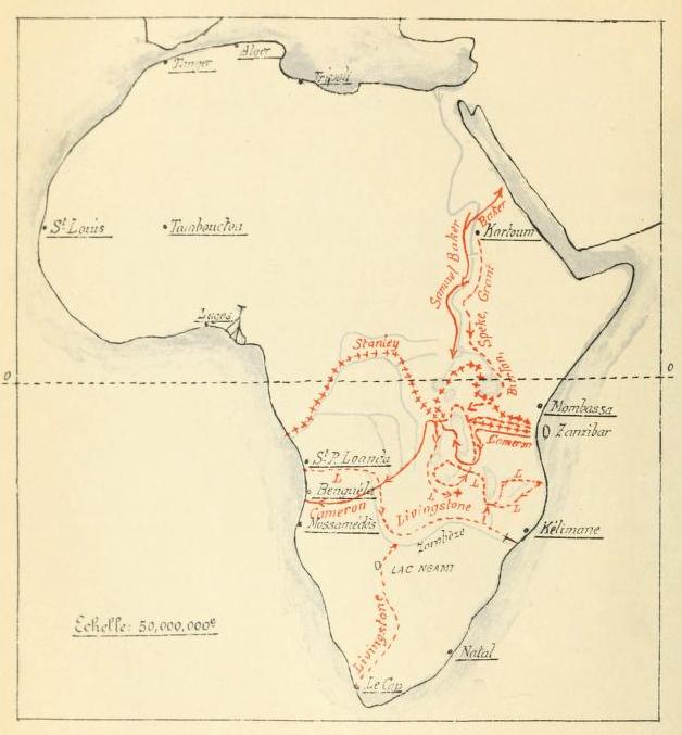
Les explorations du Sud et du Centre africains jusquen 1876
1913 · Wikimedia Commons

Etat des connaissances sur lAfrique en 1876
1913 · Wikimedia Commons