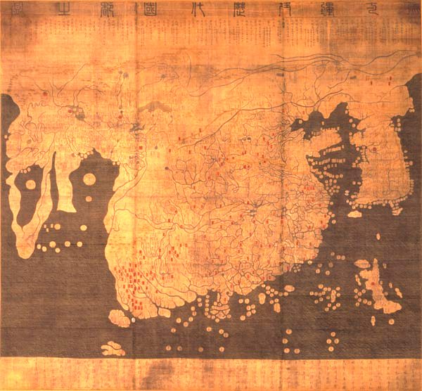

map (1402). The later Honkōji version of the map is available here: GeneralMapOfDistancesAndHistoricCapitals.jpg at a higher resolution
- Date
- 1402
- Mapmaker / publisher
- Kim Sahyung, Lee Moo, Lee Hui
- Archive
- Wikimedia Commons
- Type
- map
- Original size
- 600 × 556 pixels
Public domainsafest
Reason: its maker died more than 100 years ago.
Read from: Commons licence category: PD-old-100; no CC BY, CC BY-SA, GFDL or deletion tag on the file page.
Credit line
"map (1402). The later Honkōji version of the map is available here: GeneralMapOfDistancesAndHistoricCapitals.jpg at a higher resolution" (1402). Kim Sahyung, Lee Moo, Lee Hui, via Wikimedia Commons. Public domain. https://commons.wikimedia.org/wiki/File:KangnidoMap.jpgNeed maps for a whole project? Add Find Any Map to Claude and ask for this one by its id: 145271.
More like this

General map of the distances and the historic capitals (chinese: Hunyi jiangli lidai guodu zhi tu; japanese: Kon'itsu kyoori rekidai kokuto no zu), Korea, roughly 1402. Ink and paint on paper. Height
1402 · Wikimedia Commons

The Yale world map of "Henricus Martellus Germanus" (Heinrich Hammer), probably from Florence 1490-92. It is the most detailed "Dragon Tail" map by Martellus. It is the only one with a coordinate grid
1490 · Wikimedia Commons

Chosŏn chido.
1730 · Library of Congress

Da Ming yi tong shan he tu.
1721 · 14 sheets

Africa and the Mediterranean in the Kangnido map
15th century · Wikimedia Commons

Romanized. Form AACR2: ga37 2007-12-03
1700 · Gyeonggi-do, plate 3

One map shows Ming Empire of China and the other map shows the world. Relief shown pictorially. Pen-and-ink and watercolor. Title from verso in red ink: Chʻŏnha Chungguk. Possibly based on early map (
1800 · Library of Congress

Korean map in 1899
1899 · Wikimedia Commons