

Madjarska okupacija Backe i Baranje, 1941-1944
Srpski: Mađarska okupacija Bačke i Baranje, 1941-1944. Područje okupacije je upoređeno sa područjem srezova u kojima su govornici mađarskog bili u većini prema popisu iz 1931. Stanovništvo kojem maternji jezik nije bio mađarski činilo je većinu u najvećem delu ove teritorije koju je okupirala Mađarska. Korišćeni su podaci sa popisa iz 1931. iz ovog izvora: Jugoslovenske teritorije koje je u Drugom svetskom ratu okupirala Mađarska mogu se videti ovde: Hungarian occupation of Bačka and Baranja, 1941-1944. Area of occupation is compared with area of municipalities where speakers of Hungarian were in majority according to 1931 census. Population whose native language was not Hungarian formed the majority of inhabitants in most parts of this territory that was occupied by Hungary. I used 1931 census data from this source: Yugoslav territories occupied by Hungary in WW2 could be seen here
- Date
- 2011
- Mapmaker / publisher
- PPetrovic
- Place
- languages in Serbia
- Archive
- Wikimedia Commons
- Type
- map
- Original size
- 886 × 864 pixels
Public domain
Reason: public domain: self.
This status rests on the map's publication history, as researched by Wikimedia Commons. Check it before commercial use.
Read from: Commons licence category: PD-self; no CC BY, CC BY-SA, GFDL or deletion tag on the file page.
Credit line
"Madjarska okupacija Backe i Baranje, 1941-1944" (2011). PPetrovic, via Wikimedia Commons. Public domain. https://commons.wikimedia.org/wiki/File:Madjarska_okupacija_Backe_i_Baranje,_1941-1944.pngNeed maps for a whole project? Add Find Any Map to Claude and ask for this one by its id: 23756.
More like this

Ethnographic map of Backa and Baranja 1931
1931 · Wikimedia Commons

Occupation of vojvodina-sr
Wikimedia Commons

Occupation of vojvodina
April 14, 2007 · Wikimedia Commons
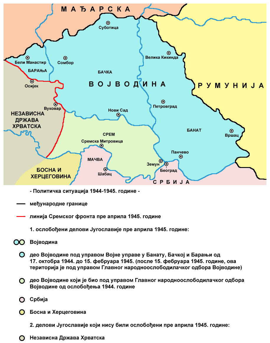
Vojvodina 1944 1945 02
June 29, 2009 · Wikimedia Commons

Vojvodina 1944 1945 01
June 29, 2009 · Wikimedia Commons

Racija1942 02
June 30, 2009 · Wikimedia Commons

Kingdom of Hungary - Ethnic Map - 1941
2015 · Wikimedia Commons

Hungary map 1941-sr
2014 · Wikimedia Commons