

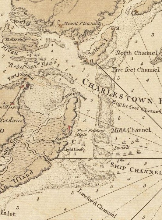
Lampriers Point (d), Mount Pleasant and Fort Moultrie (a) 1780
- Date
- 1780
- Place
- the American Revolution
- Archive
- Wikimedia Commons
- Type
- map
- Original size
- 525 × 357 pixels
Public domainsafest
Reason: its maker died more than 70 years ago.
Read from: Commons licence category: PD-old-70-expired; no CC BY, CC BY-SA, GFDL or deletion tag on the file page.
Credit line
"Lampriers Point (d), Mount Pleasant and Fort Moultrie (a) 1780" (1780). Wikimedia Commons. Public domain. https://commons.wikimedia.org/wiki/File:Charleston_(1780).jpgNeed maps for a whole project? Add Find Any Map to Claude and ask for this one by its id: 295719.
More like this

(The Investiture of Charleston, S.C. by the English army, in 1780. With the position of each corps.
1780 · Library of Congress

Atlas of the battles of the American Revolution, together with maps shewing the routes of the British and American Armies, plans of cities, surveys of harbors, etc.
1845 · Charleston, South Carolina, plate 12
Charlestown Bar
1780 · Wikimedia Commons

Charleston Harbor S.C. Bombardment of Fort Sumter.
1861 · Library of Congress

Map of Morris, Folly, Coles and James Island(s) etc., and Charleston Harbor S.C. shewing (sic) Union and Rebel forts and batteries, 1864.
1863 · Library of Congress

(Plan d'Amboy. Vues de la rade de Charles-Town et de Fort Sulivan, mai 1780.
1780 · Library of Congress

Plan de la ville de Charlestown, de ses retranchements et du siege faits par les Anglois en 1780.
1780 · Library of Congress

Charleston Harbor and its Approaches Showing the positions of the Rebel Batteries, 1863 and annotated to show the status of the siege of the city, July 17, 1863
1863 · U.S. National Archives