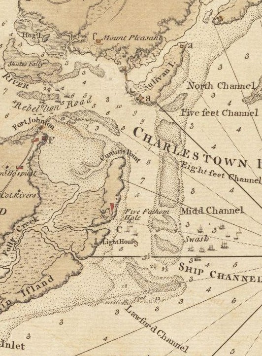

Charlestown Bar
Map, showing Charleston Bar and the coastline. The map was probably drawn by British engineers around the time of the 1780 Siege of Charleston.
- Date
- 1780
- Place
- the American Revolution
- Archive
- Wikimedia Commons
- Type
- map
- Original size
- 532 × 722 pixels
Public domainsafest
Reason: its maker died more than 70 years ago.
Read from: Commons licence category: PD-old-70-expired; no CC BY, CC BY-SA, GFDL or deletion tag on the file page.
Credit line
"Charlestown Bar" (1780). Wikimedia Commons. Public domain. https://commons.wikimedia.org/wiki/File:Charlestown_Bar_(1780).jpgNeed maps for a whole project? Add Find Any Map to Claude and ask for this one by its id: 295718.
More like this

A sketch of the operations before Charlestown, the capital of South Carolina
1780 · Library of Congress

Atlas of the battles of the American Revolution, together with maps shewing the routes of the British and American Armies, plans of cities, surveys of harbors, etc.
1845 · Charleston, South Carolina, plate 12

(The Investiture of Charleston, S.C. by the English army, in 1780. With the position of each corps.
1780 · Library of Congress

A plan of the town, bar, harbour, and environs of Charlestown in South Carolina - with all the channels, soundings, sailing-marks etc. from the surveys made in the colony.
1780 · Library of Congress

The Atlantic Neptune, published for the use of the Royal Navy of Great Britain
1800 · Charleston, South Carolina, plate 1

Lampriers Point (d), Mount Pleasant and Fort Moultrie (a) 1780
1780 · Wikimedia Commons

The North-American pilot for New England, New York, Pensilvania, Maryland, and Virginia; also, the two Carolinas, and Florida.
1777 · Charleston, South Carolina, plate 10

Sketch of the coast from South Edisto to Charles Town, 1st March 1780.
1780 · Library of Congress