

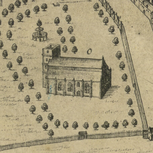
King James' College, Edinburgh c.1647
The Tounis College of Edinburgh, founded by royal charter in 1582 and known as King James' College after 1617, was built in the grounds of the pre-Reformation Collegiate Church of St. Mary-of-the-Fields (Kirk o' Field). The main college buildings forming a double courtyard can be seen lower left, with the grounds extending eastwards towards the limit of the town wall. This image is annotated on its description page.
- Date
- 1647
- Mapmaker / publisher
- James Gordon of Rothiemay
- Place
- Edinburgh
- Archive
- Wikimedia Commons
- Type
- map
- Original size
- 2,560 × 1,920 pixels
Public domain
Reason: its maker died long enough ago that the copyright has expired.
This status rests on the map's publication history, as researched by Wikimedia Commons. Check it before commercial use.
Read from: Commons licence category: PD Old; no CC BY, CC BY-SA, GFDL or deletion tag on the file page.
Credit line
"King James' College, Edinburgh c.1647" (1647). James Gordon of Rothiemay, via Wikimedia Commons. Public domain. https://commons.wikimedia.org/wiki/File:King_James%27_College,_Edinburgh_c.1647.JPGNeed maps for a whole project? Add Find Any Map to Claude and ask for this one by its id: 244058.
More like this

Trinity College Kirk c.1647
1647 · Wikimedia Commons
Greyfriars 1647
1647 · Wikimedia Commons

Drawing of the Kirk o' Field after the murder of Henry Stuart, Lord Darnley. Original size: 40×57.5cm.
1567 · Wikimedia Commons

Edinburgh Civitates Orbis Terrarum
1582 · Wikimedia Commons

Civitates orbis terrarvm.
1612 · Edinburgh, plate 14

Edenburgum Scotiae Metropolis
1574–1594 · BM Y,5.161

Contrafactur und Beschreibung von den vornembsten Stetten der Welt. Liber tertius (page 16)
1582 · Wikimedia Commons

STEVENSON(1855) p011 EDENBURG IN 1575
1855 · Wikimedia Commons