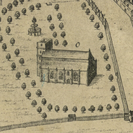

Greyfriars 1647
A detail of James Gordon of Rothiemay's 1647 map of Edinburgh, showing Greyfriars Kirk. This is the only depiction of the church before an explosion of 1718 destroyed the west tower. The church was subsequently restored and extended.
- Date
- 1647
- Mapmaker / publisher
- James Gordon of Rothiemay (c. 1615-1687)
- Place
- Edinburgh
- Archive
- Wikimedia Commons
- Type
- map
- Original size
- 531 × 532 pixels
Public domainsafest
Reason: its maker died more than 70 years ago.
Read from: Commons licence category: PD-old-70-expired; no CC BY, CC BY-SA, GFDL or deletion tag on the file page.
Credit line
"Greyfriars 1647" (1647). James Gordon of Rothiemay (c. 1615-1687), via Wikimedia Commons. Public domain. https://commons.wikimedia.org/wiki/File:Greyfriars_1647.pngNeed maps for a whole project? Add Find Any Map to Claude and ask for this one by its id: 244060.
More like this

Trinity College Kirk c.1647
1647 · Wikimedia Commons

King James' College, Edinburgh c.1647
1647 · Wikimedia Commons

Drawing of the Kirk o' Field after the murder of Henry Stuart, Lord Darnley. Original size: 40×57.5cm.
1567 · Wikimedia Commons

Edinburgh Civitates Orbis Terrarum
1582 · Wikimedia Commons

A new and exact map of Great Britannie & c
1667 · BM Q,8.227

Civitates orbis terrarvm.
1612 · Edinburgh, plate 14

Edenburgum Scotiae Metropolis
1574–1594 · BM Y,5.161

16th Century Map of Cork - Extracted and replicated from Pacata Hibernia page 137
1585–1633 · Wikimedia Commons