

KangnidoPoliticalDetails
- Archive
- Wikimedia Commons
- Type
- map
- Original size
- 779 × 720 pixels
Public domain
Reason: its maker died more than 70 years ago, and a faithful scan of a flat work adds no new copyright.
This status rests on the map's publication history, as researched by Wikimedia Commons. Check it before commercial use.
Read from: Commons licence category: PD-Art (PD-old-70); no CC BY, CC BY-SA, GFDL or deletion tag on the file page.
Credit line
"KangnidoPoliticalDetails". Wikimedia Commons. Public domain. https://commons.wikimedia.org/wiki/File:KangnidoPoliticalDetails.jpgNeed maps for a whole project? Add Find Any Map to Claude and ask for this one by its id: 145274.
More like this

645px-KangnidoCaption
Wikimedia Commons

Kangnido vs FraMauro
Wikimedia Commons

Africa and the Mediterranean in the Kangnido map
15th century · Wikimedia Commons

Gwang Yeodo 18th century
1737 · Wikimedia Commons

Kangwŏn-do chido.
1800 · Library of Congress
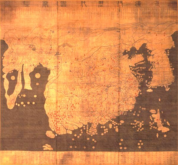
map (1402). The later Honkōji version of the map is available here: GeneralMapOfDistancesAndHistoricCapitals.jpg at a higher resolution
1402 · Wikimedia Commons

Cheonhado Readable
Wikimedia Commons

Dongguk daejido late 1700
1700 · Wikimedia Commons