

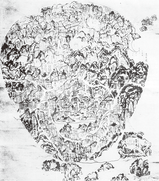
Jūkai, Map of the Five Regions of Tenjiku (or Gotenjiku-zu), 1364. Hanging scroll; ink and color on paper, 177 × 166.5 cm. Hōryūji, Nara
- Date
- 1364
- Mapmaker / publisher
- Jūkai
- Place
- Asia
- Archive
- Wikimedia Commons
- Type
- map
- Original size
- 793 × 859 pixels
Public domainsafest
Reason: its maker died more than 70 years ago, and a faithful scan of a flat work adds no new copyright.
Read from: Commons licence category: PD-Art (PD-old-70); no CC BY, CC BY-SA, GFDL or deletion tag on the file page.
Credit line
"Jūkai, Map of the Five Regions of Tenjiku (or Gotenjiku-zu), 1364. Hanging scroll; ink and color on paper, 177 × 166.5 cm. Hōryūji, Nara" (1364). Jūkai, via Wikimedia Commons. Public domain. https://commons.wikimedia.org/wiki/File:Gotenjikuzu.pngNeed maps for a whole project? Add Find Any Map to Claude and ask for this one by its id: 239564.
More like this

Buddhist map of the world
Wikimedia Commons

ink on paper, before 1600 AD
1600 · Wikimedia Commons

Map of Japan (Jotokuji Fukui)
1568–1600 · Wikimedia Commons

Map Dividing the Hiokikitagō Estate in Satsuma (From the Shimazu family's collction of documents)
1324 · Wikimedia Commons

Pictorial Map of Engaku-ji Precincts (Shihon Tansai Engakuji Keidai Ezu)
1791 · Wikimedia Commons

Aḍhāī-dvīpa, ‘Two and a half continents’. Painting on cloth, 18th century (British Library Or 13937)
Wikimedia Commons
Five Regions of India by Ninkai
1736 · Wikimedia Commons

1710 Japanese world map
1710 · Wikimedia Commons