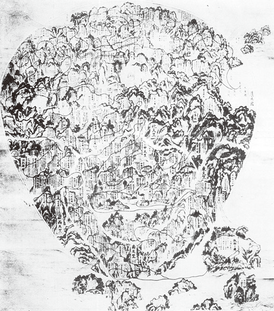

Five Regions of India by Ninkai
- Date
- 1736
- Mapmaker / publisher
- 忍海
- Place
- India
- Archive
- Wikimedia Commons
- Type
- map
- Original size
- 535 × 608 pixels
Public domainsafest
Reason: public domain: Art (PD-Japan).
Read from: Commons licence category: PD-Art (PD-Japan); no CC BY, CC BY-SA, GFDL or deletion tag on the file page.
Credit line
"Five Regions of India by Ninkai" (1736). 忍海, via Wikimedia Commons. Public domain. https://commons.wikimedia.org/wiki/File:Five_Regions_of_India_by_Ninkai.pngNeed maps for a whole project? Add Find Any Map to Claude and ask for this one by its id: 255005.
More like this

1710 Japanese Buddhist map of the World - Nansenbushu Bankoku Shoka No Zu - Outline Map of All Countries of the Universe
1710 · Wikimedia Commons

Dai-Nihonkoku no Chizu
1715 · Wikimedia Commons

Nansenbushū bankoku shōka no zu
1710 · Library of Congress

Cartes generales de toutes les parties du monde, ou les empires, monarchies, republiques, estats, peuples, &c. de l'Asie, de l'Afrique, de l'Europe, & de l'Americque, tant anciens que nouveaux, sont exactement remarqués, & distingués suivant leur estendue. Par le Sieur Sanson d'Abbeville, Geographe
1658 · India, plate 35 of 388

ink on paper, before 1600 AD
1600 · Wikimedia Commons

India, or the Mogul's Empire.
1701 · New York Public Library

Atlas type Lafréri
1543–1577 · India, plate 208 of 226

Map of Southeast Asia and India with relief shown pictorially.
1750 · Wikimedia Commons