

India. Edinburgh, Published by A. &. C. Black. Engraved by S. Hall, Bury Strt. Bloomsbry.
Zoomable full resolution image available at davidrumsey.com. This image //www.davidrumsey.com/luna/servlet/view/search?q=list_no=%222305.044%22 2305.044 is a part of image group 2305.000. Engraved. Relief shown by hachures. States shown by tinting. Inset of Island of Singapore. New Edition on Title page. Has three maps of the states that appear here for the first time, hand colored. New York, Vermont, New Hampshire.Connecticut; Kentucky and Tennessee; and Maine. These maps appear in Black's Atlas of North America (1856) and in the General Atlas American Edition (1857) but they are printed in colors, not hand colored. Also, the map of Mexico includes the California Gold Regions colored in gold. This edition represents a significant change of maps for Black; Phillips lists the entire contents, which he rarely does for an atlas of this period, indicating his view of its importance. P4334. Subjects
- Mapmaker / publisher
- Black, Adam & Charles:Hall, Sidney:Hughes, William
- Place
- South Asia
- Archive
- Wikimedia Commons
- Type
- atlas page
- Original size
- 7,596 × 11,353 pixels
Public domain
Reason: its maker died more than 100 years ago.
This status rests on the map's publication history, as researched by Wikimedia Commons. Check it before commercial use.
Read from: Commons licence category: PD-old-100-expired; no CC BY, CC BY-SA, GFDL or deletion tag on the file page; permission field: Images may be downloaded and used following Creative Commons CC BY-NC-SA 3.0 license. Image credit should be given to "D.
Credit line
"India. Edinburgh, Published by A. &. C. Black. Engraved by S. Hall, Bury Strt. Bloomsbry.". Black, Adam & Charles:Hall, Sidney:Hughes, William, via Wikimedia Commons. Public domain. https://commons.wikimedia.org/wiki/File:India._Edinburgh,_Published_by_A._%26._C._Black._Engraved_by_S._Hall,_Bury_Strt._Bloomsbry._(IA_dr_india-edinburgh-published-by-a-c-black-engraved-by-s-hall-bury-st-2305044).jpgNeed maps for a whole project? Add Find Any Map to Claude and ask for this one by its id: 241901.
More like this

India or Hindostan.
1855 · Wikimedia Commons
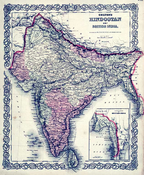
Map of British India, 1855. Published by G. W. and C. B. Colton and Company in New York, 1855. It was derived from an earlier wall map of the world produced by Colton and D. Griffing Johnson. Covers t
1855 · Wikimedia Commons

India Map 1860
1860 · Wikimedia Commons

India. Publisher: Henry Teesdale & Co. Publisher Location: London Type: Atlas Map Obj Height cm: 67 Obj Width cm: 46 Scale 1:5,300,000 Reference: cf P796. Country: India Country: Sri Lanka Region: Southwest Asia Full Title: India from Authorities Principally for Use of the Officers of the Army of In
1843–1844 · Wikimedia Commons

Hindoostan. By Sidney Hall. London, published by Longman, Rees, Orme, Brown & Green, Paternoster Row, Novr. 1st. 1827.
1827 · Wikimedia Commons

Zoomable full resolution image available at davidrumsey.com. This image //www.davidrumsey.com/luna/servlet/view/search?q=list_no=%221585.047%22 1585.047 is a part of image group 1585.000. American edi
1585 · South India

British India John Tallis
1851 · Wikimedia Commons

Map of British India and the Straits Settlements
1860 · Wikimedia Commons