

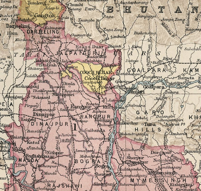
IGIBengal with Sikkim 1908
Bengal with Sikkim from Imperial Gazetteer of India Atlas, 1908
- Date
- 1908
- Mapmaker / publisher
- J Bartholomew, Edinburgh Geographical Institute
- Place
- Bengal Presidency
- Archive
- Wikimedia Commons
- Type
- map
- Original size
- 1,654 × 1,978 pixels
Public domainsafest
Reason: its maker died more than 70 years ago.
Read from: Commons licence category: PD-old-70-expired; no CC BY, CC BY-SA, GFDL or deletion tag on the file page.
Credit line
"IGIBengal with Sikkim 1908" (1908). J Bartholomew, Edinburgh Geographical Institute, via Wikimedia Commons. Public domain. https://commons.wikimedia.org/wiki/File:IGIBengal_with_Sikkim_1908.jpgNeed maps for a whole project? Add Find Any Map to Claude and ask for this one by its id: 256695.
More like this

IGI1908 Madras Northern Section
1908 · Wikimedia Commons
Cooch Behar from 1931 Imperial Gazetteer
1931 · Wikimedia Commons

British Indian Empire Imperial Gazetteer of India 1908 High Resolution
December 31, 1908 · Wikimedia Commons

Calcutta Sheet 79, 1:1,000,000
1917 · Wikimedia Commons

India Vegetation Features IGI 1909 Atlas
1909 · Wikimedia Commons

Easter Bengal and Assam with Bhutan
1909 · Wikimedia Commons

Map-The Indian Empire-Prepared for William Wilson Hunter's-Imperial Gazetteer of India
1898 · Wikimedia Commons

1907 Map showing East Bengal and Assam
1907 · Wikimedia Commons