

Ibn al Wardi's atlas
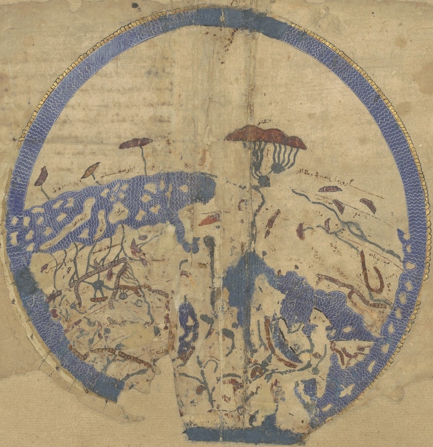
Ibn al-Wardi's atlas of the world (~1450) 日本語: アル・ワルディー図 (1349年) At the center of the map are Mecca and Medina, the two holiest cities of Islam. The north part of the map shows "China and India", and the south part shows "Christian sects and the states of Byzantium". The outer circles represent the seas. The manuscript is a cosmology and aims to present the reader with a systematic overview of the existing knowledge about the world, among Islamic scholars in late 17th century CE. The drawing and text is by 'Umar bin Muzaffar Ibn al-Wardi. Kharidat al-'Aja'ib wa Faridat al-Ghara'ib. (The Pearl of Wonders and the Uniqueness of Things Strange). Late seventeenth century.
- Date
- c. 1450
- Mapmaker / publisher
- Abū Ḥafs Zayn al-Dīn ʻUmar ibn al-Muẓaffar Ibn al-Wardī
- Archive
- Wikimedia Commons
- Type
- atlas page
- Original size
- 1,000 × 665 pixels
Public domainsafest
Reason: its maker died more than 100 years ago.
Read from: Commons licence category: PD-old-100-expired; no CC BY, CC BY-SA, GFDL or deletion tag on the file page.
Credit line
"Ibn al Wardi's atlas" (c. 1450). Abū Ḥafs Zayn al-Dīn ʻUmar ibn al-Muẓaffar Ibn al-Wardī, via Wikimedia Commons. Public domain. https://commons.wikimedia.org/wiki/File:Ibn_al_Wardi%27s_atlas.jpgNeed maps for a whole project? Add Find Any Map to Claude and ask for this one by its id: 21360.
More like this

Ibn Wardi mappa mundi
c. 1349 · Wikimedia Commons

This is a composite image of fol. 3v–4r, from University of Pennsylvania Rare Book & Manuscript Library, LJS 495, Kharīdat al-ʻajāʼib wa farīḍat al-gharāʼib, by Ibn al-Wardī, Sirāj al-Dīn Abū Ḥafṣ ʻUm
1457 · Wikimedia Commons

Aja'ib al-Makhluqat by Zakariya al-Qazwini
c. 1530 · Wikimedia Commons
Idrisi MS BNF Ar 2221 f 3v-4r
1250–1325 · Wikimedia Commons

Ibn Wardi Kaaba map
c. 1349 · Wikimedia Commons

Map of World
Wikimedia Commons

Rectangular world map from Fatimid treatise, Book of Curiosities of the Sciences and Marvels for the Eyes, copy of manuscript originally written in the first half of the 11th century
Wikimedia Commons

1420 Sallust de Geneve
1420 · Wikimedia Commons