

Holy Roman Empire around 1000
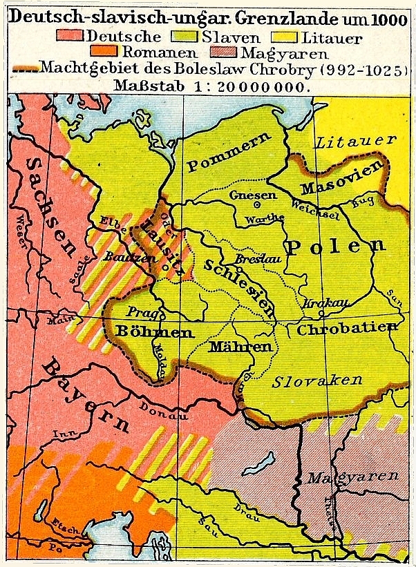
Map of the Holy Roman Empire (northern region) circa 1000 CE, according to the plate 22 & 23 of the Allgemeiner historischer Handatlas (Bielfeld-Leipzig, 1886), composed by German scholars Johann Gustav Droysen and Richard Andree.
- Date
- 1886
- Mapmaker / publisher
- Gustav Droysen
- Place
- the Holy Roman Empire from Allgemeiner Historischer Handatlas
- Archive
- Wikimedia Commons
- Type
- map
- Original size
- 11,584 × 9,344 pixels
Public domainsafest
Reason: its maker died more than 100 years ago.
Read from: Commons licence category: PD-old-100-expired; no CC BY, CC BY-SA, GFDL or deletion tag on the file page.
Credit line
"Holy Roman Empire around 1000" (1886). Gustav Droysen, via Wikimedia Commons. Public domain. https://commons.wikimedia.org/wiki/File:Holy_Roman_Empire_around_1000_(134037775).jpgNeed maps for a whole project? Add Find Any Map to Claude and ask for this one by its id: 252419.
More like this

Heiliges Römisches Reich 1000
1886 · Wikimedia Commons

Germany in the year 1000 (Droysen)
1886 · Wikimedia Commons

Holy Roman Empire around 1400
1886 · Wikimedia Commons

C. 1000 Western Europe
c. 1911 · Wikimedia Commons

F.W. Putzgers Historischer Schul-Atlas: zur alten, mittleren und neuen Geschichte: in 66 Haupt- und 63 Nebenkarten
Wikimedia Commons
Germanisch-Slawisch-Ungarisches Mitteleuropa um 1000
Wikimedia Commons

F. W. Putzgers Historischer Schul-Atlas: zur alten, mittleren und neuen Geschichte
Wikimedia Commons

Central Europe in Carolingian times
1886 · Wikimedia Commons