

Heiliges Römisches Reich 1000
Plate 22 & 23 of the Allgemeiner historischer Handatlas (Bielfeld-Leipzig, 1886), composed by German scholars Johann Gustav Droysen and Richard Andree.
- Date
- 1886
- Mapmaker / publisher
- Johan Gustav Droysen
- Place
- the Holy Roman Empire from Allgemeiner Historischer Handatlas
- Archive
- Wikimedia Commons
- Type
- map
- Original size
- 6,170 × 4,941 pixels
Public domain
Reason: its maker died long enough ago that the copyright has expired.
This status rests on the map's publication history, as researched by Wikimedia Commons. Check it before commercial use.
Read from: Commons licence category: PD Old; no CC BY, CC BY-SA, GFDL or deletion tag on the file page.
Credit line
"Heiliges Römisches Reich 1000" (1886). Johan Gustav Droysen, via Wikimedia Commons. Public domain. https://commons.wikimedia.org/wiki/File:Heiliges_R%C3%B6misches_Reich_1000.PNGNeed maps for a whole project? Add Find Any Map to Claude and ask for this one by its id: 252365.
More like this

Holy Roman Empire around 1000
1886 · Wikimedia Commons

Germany in the year 1000 (Droysen)
1886 · Wikimedia Commons

C. 1000 Western Europe
c. 1911 · Wikimedia Commons
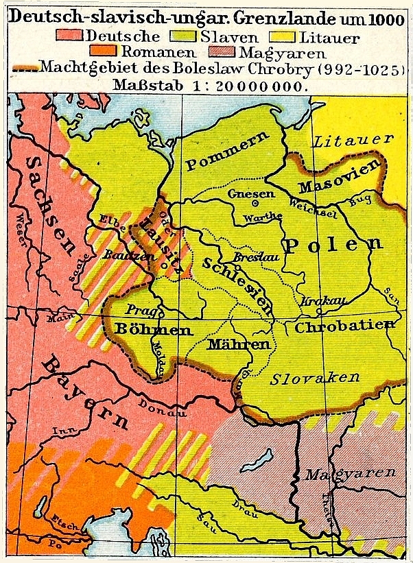
Germanisch-Slawisch-Ungarisches Mitteleuropa um 1000
Wikimedia Commons

F.W. Putzgers Historischer Schul-Atlas: zur alten, mittleren und neuen Geschichte: in 66 Haupt- und 63 Nebenkarten
Wikimedia Commons

Europe in the 10th century (Atlas of European history, 1909)
January 19, 2012 · Wikimedia Commons

F. W. Putzgers Historischer Schul-Atlas: zur alten, mittleren und neuen Geschichte
Wikimedia Commons

Holy Roman Empire around 1400
1886 · Wikimedia Commons