

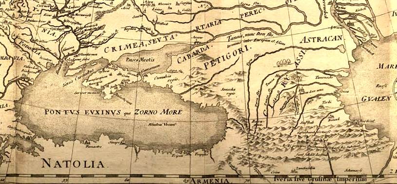
Guillaume Levasseur de Beauplan, Carte d'Vkranie, 1660 (Fragment)
Fragment of the map "Carte d’Vkranie" by Guillaume Levasseur de Beauplan, 1660. This segment depicts the western part of Circassia and the Crimean Peninsula. Ottoman fortresses (crescent symbols) and Circassian settlements (cross symbols).
- Date
- 1660
- Place
- Circassia
- Archive
- Wikimedia Commons
- Type
- map
- Original size
- 3,000 × 1,696 pixels
Public domainsafest
Reason: its US copyright has expired (published before 1931).
Read from: Commons licence category: PD US expired; no CC BY, CC BY-SA, GFDL or deletion tag on the file page.
Credit line
"Guillaume Levasseur de Beauplan, Carte d'Vkranie, 1660 (Fragment)" (1660). Wikimedia Commons. Public domain. https://commons.wikimedia.org/wiki/File:Guillaume_Levasseur_de_Beauplan,_Carte_d%27Vkranie,_1660_(Fragment).jpgNeed maps for a whole project? Add Find Any Map to Claude and ask for this one by its id: 240556.
More like this

Nicolaas Witsen. Pontus Euxinus of niewe en naaukeurige paskaart van de zwarte zee uyt verscheydene stucken van die gewelten toegesonden, ontworpen door (18th century)
Wikimedia Commons

1644 Europa Recens Blaeu Crimea
1644 · Wikimedia Commons

A. de La Motraye. Mare Nigrum (17 century) (cropped2)
Wikimedia Commons

Карта Чёрного моря, 1697 год
1697 · Wikimedia Commons
Fedor chertezh cropped
1614 · Wikimedia Commons

N. Mer Noire, tirée de l'original turc, fait á Kafa. 1697
1697 · Wikimedia Commons

A. de La Motraye. Mare Nigrum (17 century) (cropped3)
Wikimedia Commons

Guillaume Sanson - Estats de l'Empire du Grand Seigneur des Turcs - 1681 - North-West Caucasus crop
1681 · Wikimedia Commons