

Guadalupe Island nautical chart
Nautical chart of Guadalupe Island off the coast of Mexico in the eastern Pacific Ocean. Modified from Hydrographic Office chart no. 1006
- Date
- 1960
- Mapmaker / publisher
- (U.S.) Hydrographic Office
- Place
- Guadalupe Island
- Archive
- Wikimedia Commons
- Type
- chart
- Original size
- 1,154 × 1,918 pixels
Public domainsafest
Reason: a US government work.
Read from: Commons licence category: PD US Government; no CC BY, CC BY-SA, GFDL or deletion tag on the file page.
Credit line
"Guadalupe Island nautical chart" (1960). (U.S.) Hydrographic Office, via Wikimedia Commons. Public domain. https://commons.wikimedia.org/wiki/File:Guadalupe_Island_nautical_chart.pngNeed maps for a whole project? Add Find Any Map to Claude and ask for this one by its id: 295497.
More like this
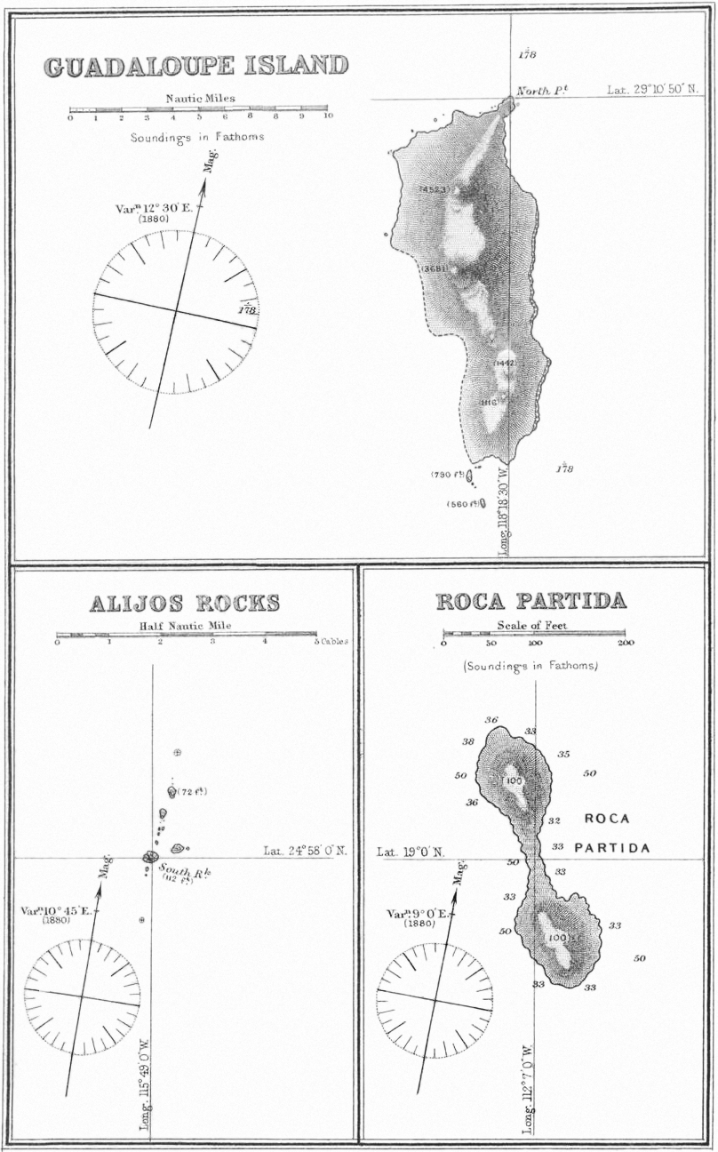
Guadaloupe Island Alijos Rocks Roca Partida 1881 sea chart
1881 · Wikimedia Commons

Fatu Hiva 1920 nautical chart
May 6, 1920 · Wikimedia Commons

1887 Chart of Raoul Island
1887 · Wikimedia Commons

Chart of Ocean Island - sketch of an island in lat. 28° 22ʹ N. long. 118° 30ʹ W. or thereabouts supposed to be Ocean Island upon which the ship Gledstanes was wrecked June 9th 1837 at 11 h. 30 m.
1837 · Library of Congress

From St. Christopher to Eustatius with Saba Island. (U. S. Hydrographic Chart. No. 369.); Maps of the Oceans / Atlantic Ocean
1872 · New York Public Library

Raivavae 1944 nautical chart
1944 · Wikimedia Commons

Guadaloupe, one of the Caribee Islands in the West Indies from the latest discovery.
1755 · Library of Congress

Isle of Pines to Uen Island 1944 nautical chart
1944 · Wikimedia Commons