

Greenland Icefields (1896) Fig 50
Enlarged map of Jensen's nunataks, with the currents and moraines of the surrounding ice sheet. (From Dana, after Jensen.)
- Date
- 1896
- Mapmaker / publisher
- James Dwight Dana after J. N. Jensen
- Place
- Greenland
- Archive
- Wikimedia Commons
- Type
- map
- Original size
- 637 × 813 pixels
Public domainsafest
Reason: its US copyright has expired (published before 1931).
Read from: Commons licence category: PD US expired; no CC BY, CC BY-SA, GFDL or deletion tag on the file page.
Credit line
"Greenland Icefields (1896) Fig 50" (1896). James Dwight Dana after J. N. Jensen, via Wikimedia Commons. Public domain. https://commons.wikimedia.org/wiki/File:Greenland_Icefields_(1896)_Fig_50.pngNeed maps for a whole project? Add Find Any Map to Claude and ask for this one by its id: 294370.
More like this

Greenland Icefields (1896) Fig 49
1896 · Wikimedia Commons

Man and the Glacial Period
1892 · Greenland
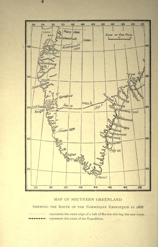
Map showing route of Nansen's first crossing of Greenland, 1888
1888 · Wikimedia Commons

Map of Cornell Glacier, Lat. 74 degrees 10 minutes tve lanternslide 0086
1896 · Wikimedia Commons

Danish Expedition to Queen Louise Land-1912–1913
1912 · Wikimedia Commons

Greenland West Coast bulletinofgeolog81897geol 0324
1896 · Wikimedia Commons

1896 sketch of the Grand Falls portage, in Labrador
1896 · Wikimedia Commons

MAJOR(1874) p67 Map of Greenland
1875 · Wikimedia Commons