

Danish Expedition to Queen Louise Land-1912–1913
(Section of Map of Greenland with routes of crossings until 1913)
- Date
- 1912
- Mapmaker / publisher
- Knud Rasmussen (1879-1933)
- Place
- Greenland
- Archive
- Wikimedia Commons
- Type
- map
- Original size
- 1,440 × 750 pixels
Public domainsafest
Reason: its maker died more than 70 years ago.
Read from: Commons licence category: PD-old-70-expired; no CC BY, CC BY-SA, GFDL or deletion tag on the file page.
Credit line
"Danish Expedition to Queen Louise Land-1912–1913" (1912). Knud Rasmussen (1879-1933), via Wikimedia Commons. Public domain. https://commons.wikimedia.org/wiki/File:Danish_Expedition_to_Queen_Louise_Land-1912%E2%80%931913.jpgNeed maps for a whole project? Add Find Any Map to Claude and ask for this one by its id: 294440.
More like this

Part of Scoresby's Map of Greenland 1823
1823 · Wikimedia Commons
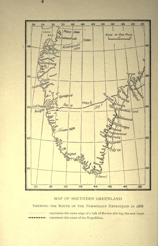
Map showing route of Nansen's first crossing of Greenland, 1888
1888 · Wikimedia Commons

Karte Nordostgrönlands 2. Dt. Nordpolarexpedition
1874 · Wikimedia Commons

Karte ostgroenland
1871 · Wikimedia Commons

Greenland Icefields (1896) Fig 49
1896 · Wikimedia Commons

Amdrup Expedition
1900 · Wikimedia Commons

Route and Surveys of the Southern Journey Party, 1908-09.
1909 · Library of Congress

MAJOR(1874) p67 Map of Greenland
1875 · Wikimedia Commons