

Gettysburg to Williamsport
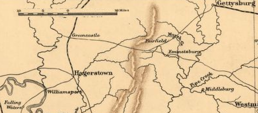
The map shows the area between Gettysburg, Pennsylvania and Williamsport, Maryland during the American Civil War. The Battle of Gettysburg took place on July 1-3, 1863. The retreat to Williamsport to cross back into Virginia followed the battle.
- Date
- 1865
- Mapmaker / publisher
- J.H. Colton & Co., modified by TwoScarsUp
- Place
- West Virginia
- Archive
- Library of Congress (via Wikimedia Commons)
- Type
- map
- Original size
- 959 × 721 pixels
Public domainsafest
Reason: its US copyright has expired (published before 1931).
Read from: Commons licence category: PD US expired; no CC BY, CC BY-SA, GFDL or deletion tag on the file page.
Credit line
"Gettysburg to Williamsport" (1865). J.H. Colton & Co., modified by TwoScarsUp. Library of Congress, Geography and Map Division, via Wikimedia Commons. Public domain. https://commons.wikimedia.org/wiki/File:Gettysburg_to_Williamsport.pngNeed maps for a whole project? Add Find Any Map to Claude and ask for this one by its id: 89.
More like this
Gettysburg - Hagerstown - Williamsport
1912 · Library of Congress

WVA - VA - MD - PA 1863
July 1, 1863 · Library of Congress

McCausland and Chambersburg
January 2, 1912 · Library of Congress

Chambersburg - Hancock - Hagerstown
1902 · Library of Congress

Gettysburg Campaign Retreat
March 25, 2006 · Wikimedia Commons

(Maps illustrating the Gettysburg campaign. June 3-July 3, 1863).
1886 · Library of Congress

Map of the Battle of Gettysburg, 1863
1863 · Wikimedia Commons

Map of Gettysburg and vicinity
1863 · Library of Congress