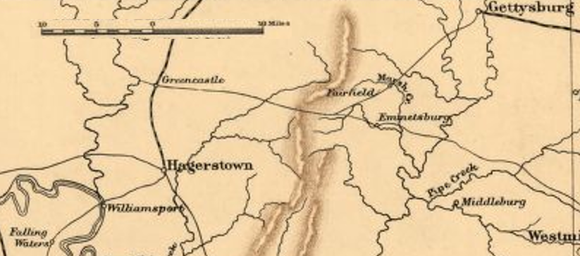

Gettysburg - Hagerstown - Williamsport
The map shows the area around Gettysburg and Williamsport during the American Civil War. Confederate General Robert E. Lee's army escaped from Gettysburg and crossed the Potomac River at Williamsport during July 1863.
- Date
- 1912
- Mapmaker / publisher
- Sifton, Praed & Company, Ltd. modified (cropped) by TwoScarsUp
- Archive
- Library of Congress (via Wikimedia Commons)
- Type
- map
- Original size
- 823 × 363 pixels
Public domainsafest
Reason: its US copyright has expired (published before 1931).
Read from: Commons licence category: PD US expired; no CC BY, CC BY-SA, GFDL or deletion tag on the file page.
Credit line
"Gettysburg - Hagerstown - Williamsport" (1912). Sifton, Praed & Company, Ltd. modified (cropped) by TwoScarsUp. Library of Congress, Geography and Map Division, via Wikimedia Commons. Public domain. https://commons.wikimedia.org/wiki/File:Gettysburg_-_Hagerstown_-_Williamsport.pngNeed maps for a whole project? Add Find Any Map to Claude and ask for this one by its id: 184.
More like this

Gettysburg to Williamsport
1865 · Library of Congress

Chambersburg - Hancock - Hagerstown
1902 · Library of Congress

McCausland and Chambersburg
January 2, 1912 · Library of Congress

Averell Approach to Moorefield
1912 · Library of Congress

Chambersburg - Moorefield Big Picture
1912 · Library of Congress

18th Pennsylvania Cavalry Shenandoah 1864-1865
1912 · Library of Congress
Northern VA 1864 Early
1912 · Library of Congress

WVA - VA - MD - PA 1863
July 1, 1863 · Library of Congress