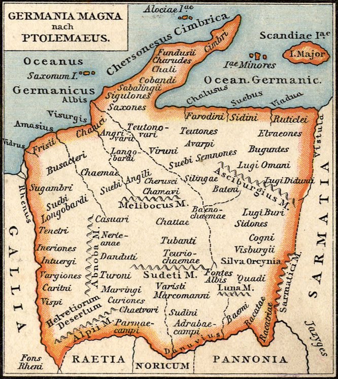

Germania Magna nach Ptolemaeus
"Greater Germany in Ptolemy", a variant of Ptolemy's 4th European Map, depicting Roman-era Germany, Austria, Bohemia, and Denmark.
- Date
- 1886
- Mapmaker / publisher
- Gustav Droysen
- Archive
- Wikimedia Commons
- Type
- map
- Original size
- 666 × 748 pixels
Public domainsafest
Reason: its maker died more than 70 years ago.
Read from: Commons licence category: PD-old-70-expired; no CC BY, CC BY-SA, GFDL or deletion tag on the file page.
Credit line
"Germania Magna nach Ptolemaeus" (1886). Gustav Droysen, via Wikimedia Commons. Public domain. https://commons.wikimedia.org/wiki/File:Germania_Magna_nach_Ptolemaeus.jpgNeed maps for a whole project? Add Find Any Map to Claude and ask for this one by its id: 254923.
More like this

Quarta Europe Tabula
1478 · Wikimedia Commons

Quarta Europe Tabula
1490 · Wikimedia Commons

Roman Britain (Droysen)
1886 · Wikimedia Commons

Germaniae Magnae Tabula ex Mente Ptolemei
1616–1650 · Wikimedia Commons

Germania Magna, Rhætia, Noricum.
1855 · Wikimedia Commons

Gaul in the time of Caesar
1886 · Wikimedia Commons

Ptolemaeus Magna Germania
Wikimedia Commons

A new map of ancient Germany, Rhætia, Vindelicia, and Noricum, shewing their principal people, tribes, cities, towns, rivers, mountains &c.
1700 · 01700 A new map of ancient Germany