

German Submarine Zone February 1915 after Reynolds et al
Map showing submarine warfare zone around the United Kingdom, declared by Germany on February 18 1915.
- Date
- 1915
- Mapmaker / publisher
- German_Submarine_Zone_February_1915_SGW_Vol_V.png: artist not identified *Europe_satellite_image_location_map.jpg: NordNordWest *derivative work: Bellhalla ( talk )
- Archive
- Wikimedia Commons
- Type
- map
- Original size
- 1,273 × 1,651 pixels
Public domain
Reason: public domain: self.
This status rests on the map's publication history, as researched by Wikimedia Commons. Check it before commercial use.
Read from: Commons licence category: PD-self; no CC BY, CC BY-SA, GFDL or deletion tag on the file page.
Credit line
"German Submarine Zone February 1915 after Reynolds et al" (1915). German_Submarine_Zone_February_1915_SGW_Vol_V.png: artist not identified *Europe_satellite_image_location_map.jpg: NordNordWest *derivative work: Bellhalla ( talk ), via Wikimedia Commons. Public domain. https://commons.wikimedia.org/wiki/File:German_Submarine_Zone_February_1915_after_Reynolds_et_al.jpgNeed maps for a whole project? Add Find Any Map to Claude and ask for this one by its id: 23039.
More like this

German Submarine Zone February 1915 SGW Vol V
1919 · Wikimedia Commons
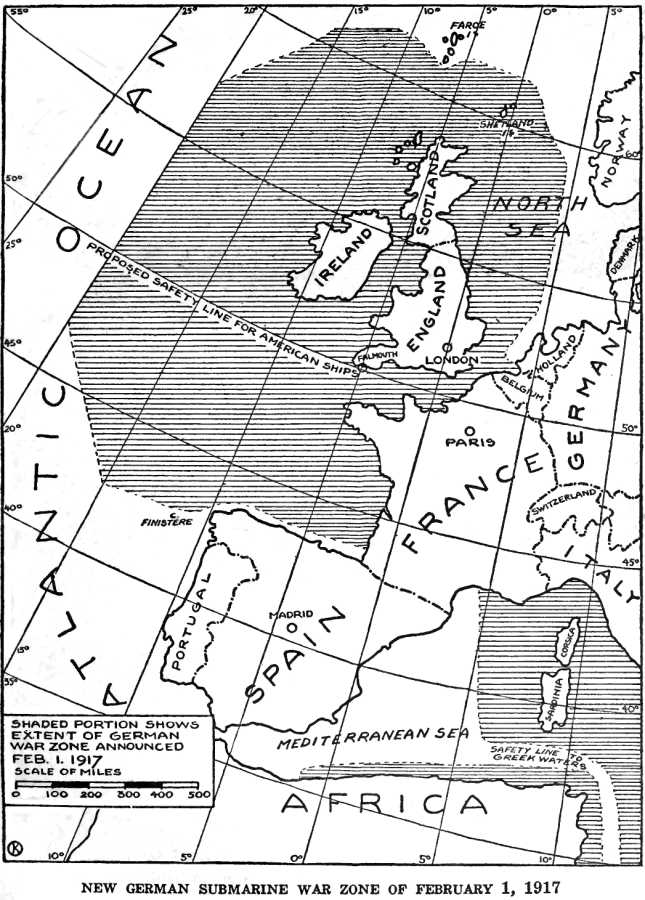
German Submarine War Zone Announced 1 February 1917
1920 · Wikimedia Commons

U-Bootskrieg - Die Sperrgebiete der europäischen Meere (North Sea crop)
1917 · Wikimedia Commons

Collier's 1921 World War - German submarine blockade
1921 · Wikimedia Commons

A German illustration of "freedom of the seas" in war time - (Western Europe and western Mediterranean Sea).
1915 · Library of Congress

Map of ships sunk in WWI 1915
September 13, 1915 · Wikimedia Commons

Jellicoe 1920 Chart C crisisofnavalwar00jellrich 0394
December 31, 1920 · Wikimedia Commons

DIAGRAMMATIC MAP OF THE AREAS CHOSEN RESPECTIVELY FOR THE BRITISH AND GERMAN AIRCRAFT RAIDS IN SEPTEMBER—DECEMBER, 1914, AND JANUARY, 1915
1915 · Wikimedia Commons