

Jellicoe 1920 Chart C crisisofnavalwar00jellrich 0394
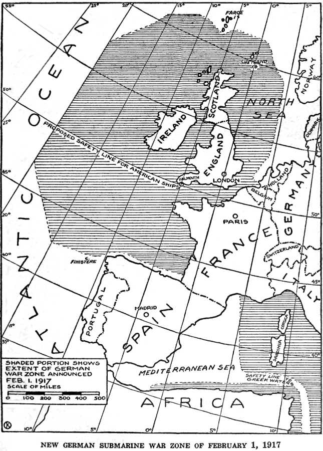
Chart C from The Crisis of the Naval War: Barred zones proclaimed by the Germans
- Date
- December 31, 1920
- Mapmaker / publisher
- John Jellicoe, 1st Earl Jellicoe, 1859-1935
- Archive
- Wikimedia Commons
- Type
- chart
- Original size
- 2,731 × 3,072 pixels
Public domainsafest
Reason: its maker died more than 70 years ago.
Read from: Commons licence category: PD-old-70-expired; no CC BY, CC BY-SA, GFDL or deletion tag on the file page.
Credit line
"Jellicoe 1920 Chart C crisisofnavalwar00jellrich 0394" (December 31, 1920). John Jellicoe, 1st Earl Jellicoe, 1859-1935, via Wikimedia Commons. Public domain. https://commons.wikimedia.org/wiki/File:Jellicoe_1920_Chart_C_crisisofnavalwar00jellrich_0394.jpgNeed maps for a whole project? Add Find Any Map to Claude and ask for this one by its id: 23073.
More like this

Jellicoe 1920 Chart E crisisofnavalwar00jellrich 0398
December 31, 1920 · Wikimedia Commons

Jellicoe 1920 Chart A crisisofnavalwar00jellrich 0388
December 31, 1920 · Wikimedia Commons

Jellicoe 1920 Chart B crisisofnavalwar00jellrich 0390
December 31, 1920 · Wikimedia Commons

Jellicoe 1920 Chart E crisisofnavalwar00jellrich 0402
December 31, 1920 · Wikimedia Commons

Jellicoe 1920 Chart F crisisofnavalwar00jellrich 0404
December 31, 1920 · Wikimedia Commons
German Submarine War Zone Announced 1 February 1917
1920 · Wikimedia Commons

German Submarine Zone February 1915 SGW Vol V
1919 · Wikimedia Commons

Collier's 1921 World War - German submarine blockade
1921 · Wikimedia Commons