

Geological Map NW England Garwood 1912 03
Geological map illustrating the lower carboniferous rocks of the Shap and Ravenstonedale districts. Plate LII from
- Date
- December 31, 1912
- Mapmaker / publisher
- Edmund Johnston Garwood
- Place
- England
- Archive
- Wikimedia Commons
- Type
- map
- Original size
- 8,929 × 8,234 pixels
Public domainsafest
Reason: its maker died more than 70 years ago.
Read from: Commons licence category: PD-old-70-expired; no CC BY, CC BY-SA, GFDL or deletion tag on the file page.
Credit line
"Geological Map NW England Garwood 1912 03" (December 31, 1912). Edmund Johnston Garwood, via Wikimedia Commons. Public domain. https://commons.wikimedia.org/wiki/File:Geological_Map_NW_England_Garwood_1912_03.jpgNeed maps for a whole project? Add Find Any Map to Claude and ask for this one by its id: 245442.
More like this

Geological Map NW England Garwood 1912 01
December 31, 1912 · Wikimedia Commons

Geological Map NW England Garwood 1912 01 (enhanced)
December 31, 1912 · Wikimedia Commons

Geological Map NW England Garwood 1912 02
December 31, 1912 · Wikimedia Commons

Geological map Cross Fell Inlier Nicholson Marr 1891
December 31, 1891 · Wikimedia Commons

Geological map Carrock Fell Harker 1895
December 31, 1895 · Wikimedia Commons

Glacial phenomena Eden Valley map Goodchild 1875
December 31, 1875 · Wikimedia Commons

Geological map Northumberland Durham Lebour 1886
December 31, 1886 · Wikimedia Commons
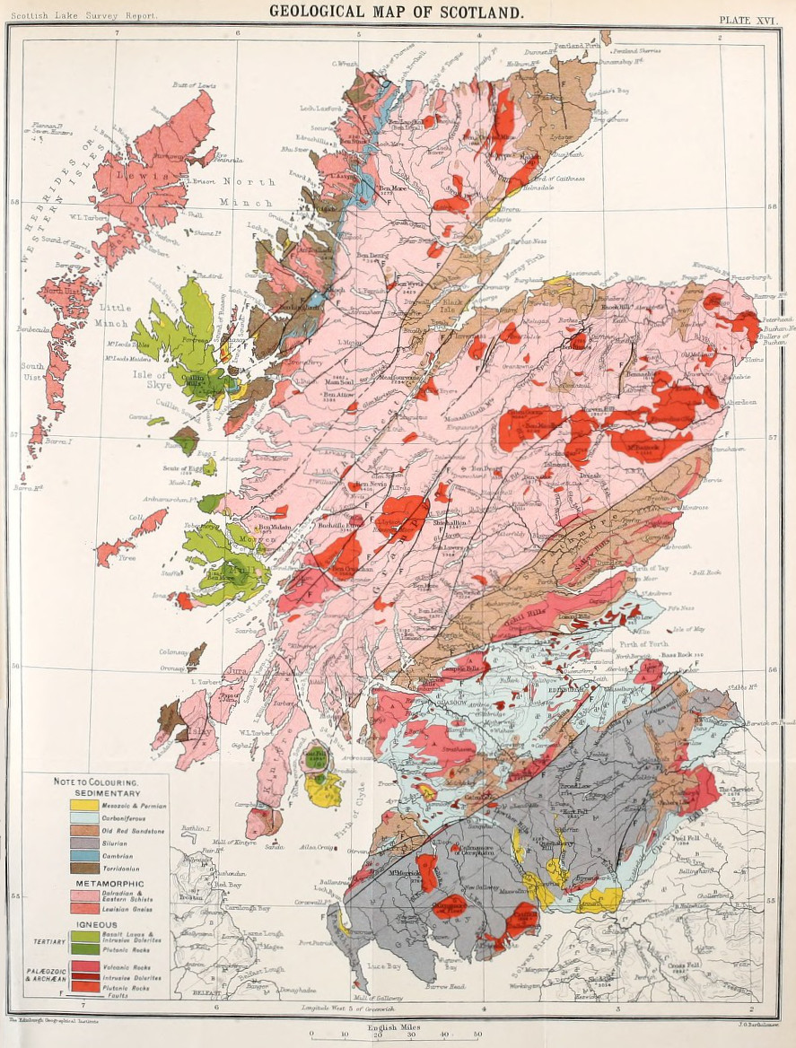
Bathymetrical survey of the lochs of Scotland, vol.I, plate XVI (Geological Map of Scotland)
1910 · Wikimedia Commons