

Geological Map NW England Garwood 1912 01 (enhanced)
Geological map illustrating the lower carboniferous rocks of the Kendal, Kirkby Lonsdale, Arnside and eastern portion of the Grange Districts. Plate LIV from
- Date
- December 31, 1912
- Mapmaker / publisher
- Edmund Johnston Garwood
- Place
- England
- Archive
- Wikimedia Commons
- Type
- map
- Original size
- 5,829 × 9,171 pixels
Public domainsafest
Reason: its maker died more than 70 years ago.
Read from: Commons licence category: PD-old-70-expired; no CC BY, CC BY-SA, GFDL or deletion tag on the file page.
Credit line
"Geological Map NW England Garwood 1912 01 (enhanced)" (December 31, 1912). Edmund Johnston Garwood, via Wikimedia Commons. Public domain. https://commons.wikimedia.org/wiki/File:Geological_Map_NW_England_Garwood_1912_01_(enhanced).jpgNeed maps for a whole project? Add Find Any Map to Claude and ask for this one by its id: 245447.
More like this

Geological Map NW England Garwood 1912 01
December 31, 1912 · Wikimedia Commons

Geological Map NW England Garwood 1912 02
December 31, 1912 · Wikimedia Commons

Geological Map NW England Garwood 1912 03
December 31, 1912 · Wikimedia Commons

Geological map Cross Fell Inlier Nicholson Marr 1891
December 31, 1891 · Wikimedia Commons

Geological map Carrock Fell Harker 1895
December 31, 1895 · Wikimedia Commons

Glacial phenomena Eden Valley map Goodchild 1875
December 31, 1875 · Wikimedia Commons

Geological map Northumberland Durham Lebour 1886
December 31, 1886 · Wikimedia Commons
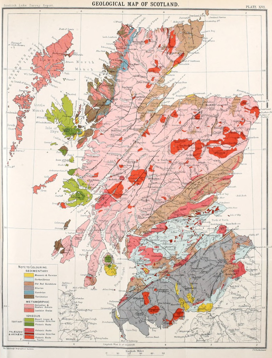
Bathymetrical survey of the lochs of Scotland, vol.I, plate XVI (Geological Map of Scotland)
1910 · Wikimedia Commons