

French World War I anti-German propaganda - Le Plan Pangermaniste
- Date
- c. 1915
- Mapmaker / publisher
- Typographie Ad. Maréchal
- Archive
- Wikimedia Commons
- Type
- map
- Original size
- 11,690 × 15,379 pixels
Public domainsafest
Reason: its maker died more than 70 years ago.
Read from: Commons licence category: PD-old-70-expired; no CC BY, CC BY-SA, GFDL or deletion tag on the file page.
Credit line
"French World War I anti-German propaganda - Le Plan Pangermaniste" (c. 1915). Typographie Ad. Maréchal, via Wikimedia Commons. Public domain. https://commons.wikimedia.org/wiki/File:French_World_War_I_anti-German_propaganda_-_Le_Plan_Pangermaniste.jpgNeed maps for a whole project? Add Find Any Map to Claude and ask for this one by its id: 144441.
More like this

Ca 1875 satirical map of Europe by Yves & Barret - Carte de la Fraternite Europeenne
c. 1875 · Wikimedia Commons
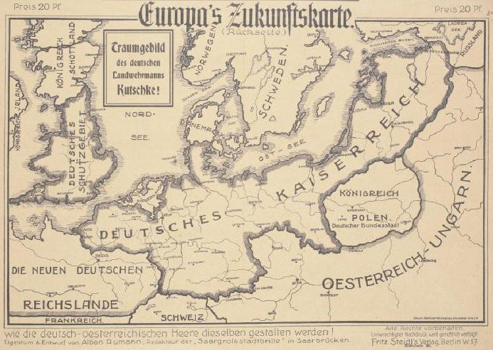
Europas Zukunftskarte 1915
1915 · Wikimedia Commons

Why Germany Wants Peace Now, 1917
1917 · Wikimedia Commons

Satyrische Europa Karte, Weltkrieg 1914 Zeichnung u. Entwurf, E. Zimmermann
1914 · Wikimedia Commons

Humoristische Karte von Europa im Jahre 1914
1914 · Wikimedia Commons

What Germany Wants Full TItle: What Germany Wants - Her Claims As Set Forth by Leaders of German Thought.
1917 · Stanford’s Geographical Establishment

Humoristische Karte von Europa im Jahre 1914
1914 · Wikimedia Commons

Unsere Front im Osten und Westen - page 1
1915 · Wikimedia Commons