

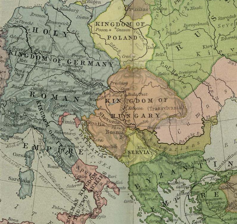
Europe at the time of the 3rd Crusade - Lane Poole
This is plate VI, titled "Europe at the time of the Third Crusade", from some versions of "Historical Atlas of Modern Europe" by Reginald Lane Poole (see en:WP for article about him), Clarendon Press, 1902. Copies of that work contain contain various subsets of the full set of plates numbered I - XC; apparently this plate VI is rarer than most. I scanned it at 600 d.p.i.
- Date
- 1902
- Mapmaker / publisher
- myself - 'Maproom'
- Archive
- Wikimedia Commons
- Type
- map
- Original size
- 8,201 × 6,390 pixels
Public domainsafest
Reason: its maker died more than 70 years ago.
Read from: Commons licence category: PD-old-70-expired; no CC BY, CC BY-SA, GFDL or deletion tag on the file page.
Credit line
"Europe at the time of the 3rd Crusade - Lane Poole" (1902). myself - 'Maproom', via Wikimedia Commons. Public domain. https://commons.wikimedia.org/wiki/File:Europe_at_the_time_of_the_3rd_Crusade_-_Lane_Poole.jpgNeed maps for a whole project? Add Find Any Map to Claude and ask for this one by its id: 249100.
More like this

C. 1190 Europe and Mediterranean Lands
c. 1911 · Wikimedia Commons

Europe and the Mediterranean Lands about 1190
1911 · Wikimedia Commons

Public Schools Historical Atlas - Europe 13th century
1905 · Wikimedia Commons

The Crusades (Atlas of European history, 1909)
January 19, 2012 · Wikimedia Commons
Europe mediterranean 1190 cropped
1923–1926 · Wikimedia Commons

Europe 912
1905 · Wikimedia Commons

Central and Western Europe at the time of the Hohenstaufens
1902 · Wikimedia Commons

Karta orienten 1190
1880 · Wikimedia Commons