

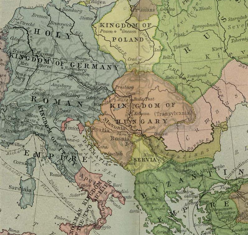
C. 1190 Europe and Mediterranean Lands
Map of Europe, Western Asia and North Africa circa 1190 CE, including the Holy Roman Empire, the Byzantine Empire and the Almohad Caliphate. Also showing: Anatolia, Seljuk Empire, Cyprus, Levant, Saladin, Iberian Peninsula, Spain, Portugal, Al-Andalus, Caliphate, Almoravid dynasty, Córdoba, Castile and León, Navarre, Aragon, France, Holy Roman Empire, Provence, Burgundy, Lorraine, Bulgaria, Croatia, Serbia, Hungary, Poland, Baltic states, Scandinavia, British Isles, Italy, Kingdom of the Two Sicilies, Armenia, Georgia, Provence, North Africa
- Date
- c. 1911
- Place
- Europe in the 12th century
- Archive
- Wikimedia Commons
- Type
- atlas page
- Original size
- 1,514 × 1,173 pixels
Public domainsafest
Reason: its maker died more than 90 years ago.
Read from: Commons licence category: PD-old-90-expired; no CC BY, CC BY-SA, GFDL or deletion tag on the file page.
Credit line
"C. 1190 Europe and Mediterranean Lands" (c. 1911). Wikimedia Commons. Public domain. https://commons.wikimedia.org/wiki/File:C._1190_Europe_and_Mediterranean_Lands.jpgNeed maps for a whole project? Add Find Any Map to Claude and ask for this one by its id: 20590.
More like this
Europe mediterranean 1190 cropped
1923–1926 · Wikimedia Commons

Europe mediterranean 1190
1923 · Wikimedia Commons

Europe mediterranean 1190
1920s · Wikimedia Commons

Karta orienten 1190
1880 · Wikimedia Commons

Europe at the time of the 3rd Crusade - Lane Poole
1902 · Wikimedia Commons

Europe and the Mediterranean Lands by Religions about 1097 (William R. Shepherd)
Wikimedia Commons

C. 1190 Western Asia Saladin
1888–1897 · Wikimedia Commons

Angevin Europe 1360
1911 · Wikimedia Commons