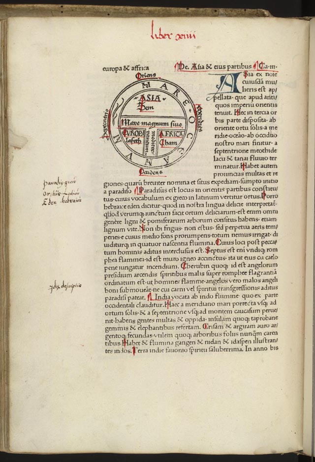

Etymologiae, Guntherus Ziner, 1472
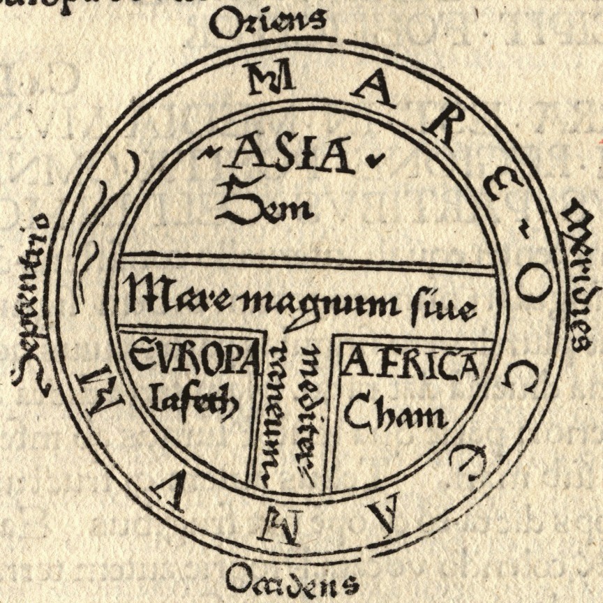
T and O style mappa mundi (map of the known world) from the first printed version of Isidorus' Etymologiae (Kraus 13). The book was written in 623 and first printed in 1472 at Augsburg by one Günther Zainer (Guntherus Ziner), Isidor's sketch thus becoming the oldest printed map of the occident.; Note: T-O-maps are typically displayed "East-up", show Jerusalem at the center and the paradise at the outmost East, balanced by the pillars of Hercules at the outmost West.
- Date
- 1472
- Mapmaker / publisher
- Guntherus Ziner
- Archive
- Wikimedia Commons
- Type
- map
- Original size
- 640 × 939 pixels
Public domainsafest
Reason: its maker died more than 100 years ago, and a faithful scan of a flat work adds no new copyright.
Read from: Commons licence category: PD-Art (PD-old-100); no CC BY, CC BY-SA, GFDL or deletion tag on the file page.
Credit line
"Etymologiae, Guntherus Ziner, 1472" (1472). Guntherus Ziner, via Wikimedia Commons. Public domain. https://commons.wikimedia.org/wiki/File:Etymologiae_Guntherus_Ziner_1472.jpgNeed maps for a whole project? Add Find Any Map to Claude and ask for this one by its id: 133785.
More like this
T and O map Guntherus Ziner 1472
1472 · Wikimedia Commons

Etimologías - Mapa del Mundo Conocido
1472 · Wikimedia Commons

Diagrammatic T-O world map - 12th century
1472 · Wikimedia Commons

EB 1911 Map Fig 9
c. 1911 · Wikimedia Commons

Noachide map from the Abbey library of Saint Gall (oldest map naming Europe), Isidore-Codex 236
Wikimedia Commons

Mer des Hystoires World Map
1491 · Unknown

Maps in a Work of Isidor
Wikimedia Commons

T and O map from Le mer des hystoires
1493 · Wikimedia Commons