

EB1911 Japan - Japan and Korea
Map of Japan and Korea. It is a synthesis of two reproductions, a color one (two pages) from and a black and white one (one page) from:File:EB1911 - Volume 15.djvu.
- Date
- 1911
- Mapmaker / publisher
- Color: "Drawn and Engraved by Justus Perthes, Gotha, Germany"; B&W: "Reproduced from Original Colorprints By The ???? Engraving Co., N.Y."
- Place
- Korea
- Archive
- Wikimedia Commons
- Type
- map
- Original size
- 2,370 × 1,641 pixels
Public domain
Reason: public domain: Britannica.
This status rests on the map's publication history, as researched by Wikimedia Commons. Check it before commercial use.
Read from: Commons licence category: PD Britannica; no CC BY, CC BY-SA, GFDL or deletion tag on the file page.
Credit line
"EB1911 Japan - Japan and Korea" (1911). Color: "Drawn and Engraved by Justus Perthes, Gotha, Germany"; B&W: "Reproduced from Original Colorprints By The ???? Engraving Co., N.Y.", via Wikimedia Commons. Public domain. https://commons.wikimedia.org/wiki/File:EB1911_Japan_-_Japan_and_Korea.jpgNeed maps for a whole project? Add Find Any Map to Claude and ask for this one by its id: 257117.
More like this

The Islands of Japan with Corea, Manchooria, and the New Russian Acquisitions
1847 · Wikimedia Commons

Map of Chosen
1929 · Wikimedia Commons

National Geographic map of Korea and Japan, 1945
1945 · Wikimedia Commons

Corea and Japan Map in 1815
1815 · Wikimedia Commons

Japan - facing page 552
1906 · Wikimedia Commons

1918 Japanese propaganda map of World War I and the Russo-Japanese War
1918 · Wikimedia Commons

Corea (sic) and Japan
1815 · Library of Congress
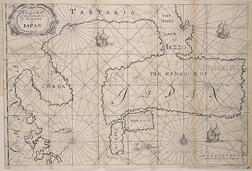
A Perfect Map of the Situation of the Land of Iapan
1663 · Wikimedia Commons