

Corea and Japan Map in 1815
The map which is written "Sea of Japan" and was published on United Kingdom in 1815
- Date
- 1815
- Mapmaker / publisher
- John & George Menzies Permission=
- Place
- Asia
- Archive
- Wikimedia Commons
- Type
- map
- Original size
- 2,161 × 1,641 pixels
Public domain
Reason: its maker died long enough ago that the copyright has expired.
This status rests on the map's publication history, as researched by Wikimedia Commons. Check it before commercial use.
Read from: Commons licence category: PD Old; no CC BY, CC BY-SA, GFDL or deletion tag on the file page.
Credit line
"Corea and Japan Map in 1815" (1815). John & George Menzies Permission=, via Wikimedia Commons. Public domain. https://commons.wikimedia.org/wiki/File:Corea_and_Japan_Map_in_1815.jpgNeed maps for a whole project? Add Find Any Map to Claude and ask for this one by its id: 241761.
More like this

Corea (sic) and Japan
1815 · Library of Congress

Corea and Japan
1817 · Wikimedia Commons

The original version of this map was created by a Matteo Ricci. In 1835, a Japanese Minosaku Sogo translated the map. East Sea is written as "Sea of Joseon". And the sea located in the right of Japan
1835 · Wikimedia Commons

MACLEOD(1819) p045 CHART OF THE EASTERN AND YELLOW SEAS
1819 · Wikimedia Commons

Japan korea map 1882 by Japan
1882 · Wikimedia Commons

EB1911 Japan - Japan and Korea
1911 · Wikimedia Commons
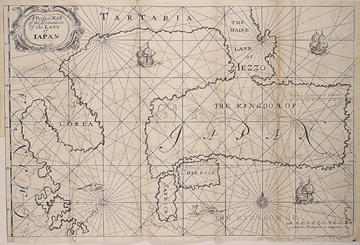
A Perfect Map of the Situation of the Land of Iapan
1663 · Wikimedia Commons

A masterpiece. This fascinating hand colored 1818 map by Edinburgh cartographer John Pinkerton depicts Korea (Corea) and Japan. A spectacular, highly detailed map of this fascinating region with spect
1818 · Wikimedia Commons