

EB 1911 Map Fig 8
Caption: " —Anglo-Saxon Map of the World (9th century)." From a Cotton MS. In Latin, with East (India and Taprobane/Sri Lanka) at the top of the map.
- Date
- c. 1911
- Mapmaker / publisher
- Presumably Emery Walker
- Archive
- Wikimedia Commons
- Type
- map
- Original size
- 2,300 × 2,790 pixels
Public domain
Reason: a US government work.
This status rests on the map's publication history, as researched by Wikimedia Commons. Check it before commercial use.
Read from: Commons licence category: PD US; no CC BY, CC BY-SA, GFDL or deletion tag on the file page; permission field: PD-US; PD-Britannica; PD-Art.
Credit line
"EB 1911 Map Fig 8" (c. 1911). Presumably Emery Walker, via Wikimedia Commons. Public domain. https://commons.wikimedia.org/wiki/File:EB_1911_Map_Fig_8.pngNeed maps for a whole project? Add Find Any Map to Claude and ask for this one by its id: 144814.
More like this
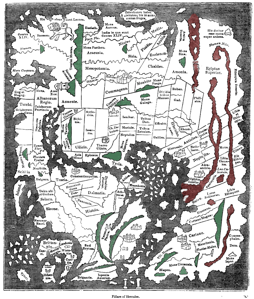
Tracing of the 'Cotton' Anglo-Saxon world map (British Library; Cotton MSS, Tib. B. V, folio 56.; date probably about AD 1000) as published ca. 1836 with printed place-names. Ceylon ("Taprobanea") is
1836 · Wikimedia Commons

Anglo-Saxon World Map Corrected
Wikimedia Commons

EB 1911 Map Fig 9
c. 1911 · Wikimedia Commons

EB 1911 Map Fig 7
c. 1911 · Wikimedia Commons
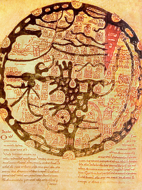
A map of the known world (mappa mundi) from an 11th century copy of the writings of Isidore of Seville (AD 560-636). East is placed at top, and the Red Sea is shown in red, as usual for such maps. Ima
Wikimedia Commons

Abbo of Fleury, Map of the world
1833 · Wikimedia Commons

1911 EB Map Fig 11
1300–1911 · Wikimedia Commons

Tabrobanum" island on the cotton world map
Wikimedia Commons