

Dislocation of the German and Russian units on land and sea while landing on the island of Ösel on October 12, 1917.
- Date
- May 26, 2009
- Mapmaker / publisher
- Nikephoros
- Archive
- Wikimedia Commons
- Type
- map
- Original size
- 771 × 686 pixels
Public domain
Reason: public domain: self.
This status rests on the map's publication history, as researched by Wikimedia Commons. Check it before commercial use.
Read from: Commons licence category: PD-self; no CC BY, CC BY-SA, GFDL or deletion tag on the file page.
Credit line
"Dislocation of the German and Russian units on land and sea while landing on the island of Ösel on October 12, 1917." (May 26, 2009). Nikephoros, via Wikimedia Commons. Public domain. https://commons.wikimedia.org/wiki/File:Tagga-Bucht.jpgNeed maps for a whole project? Add Find Any Map to Claude and ask for this one by its id: 22131.
More like this

Unternehmen Albion 13.10.1917
June 15, 2009 · Wikimedia Commons

Unternehmen Albion 17.10.1917
June 15, 2009 · Wikimedia Commons

Unternehmen Albion 15.10.1917
June 15, 2009 · Wikimedia Commons

Unternehmen Albion - Anmarsch
May 26, 2009 · Wikimedia Commons

Operation Albion Map
c. 1938 · Wikimedia Commons

Unternehmen Albion zeitgen Karte
1919 · Wikimedia Commons

Battle of Tannenberg (1914) in its last phase
1914 · Wikimedia Commons
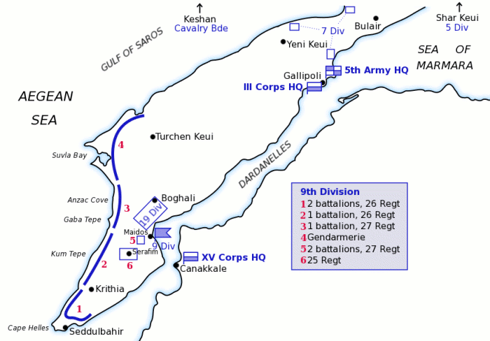
Map of Turkish forces at Gallipoli April 1915
March 12, 2004 · Wikimedia Commons