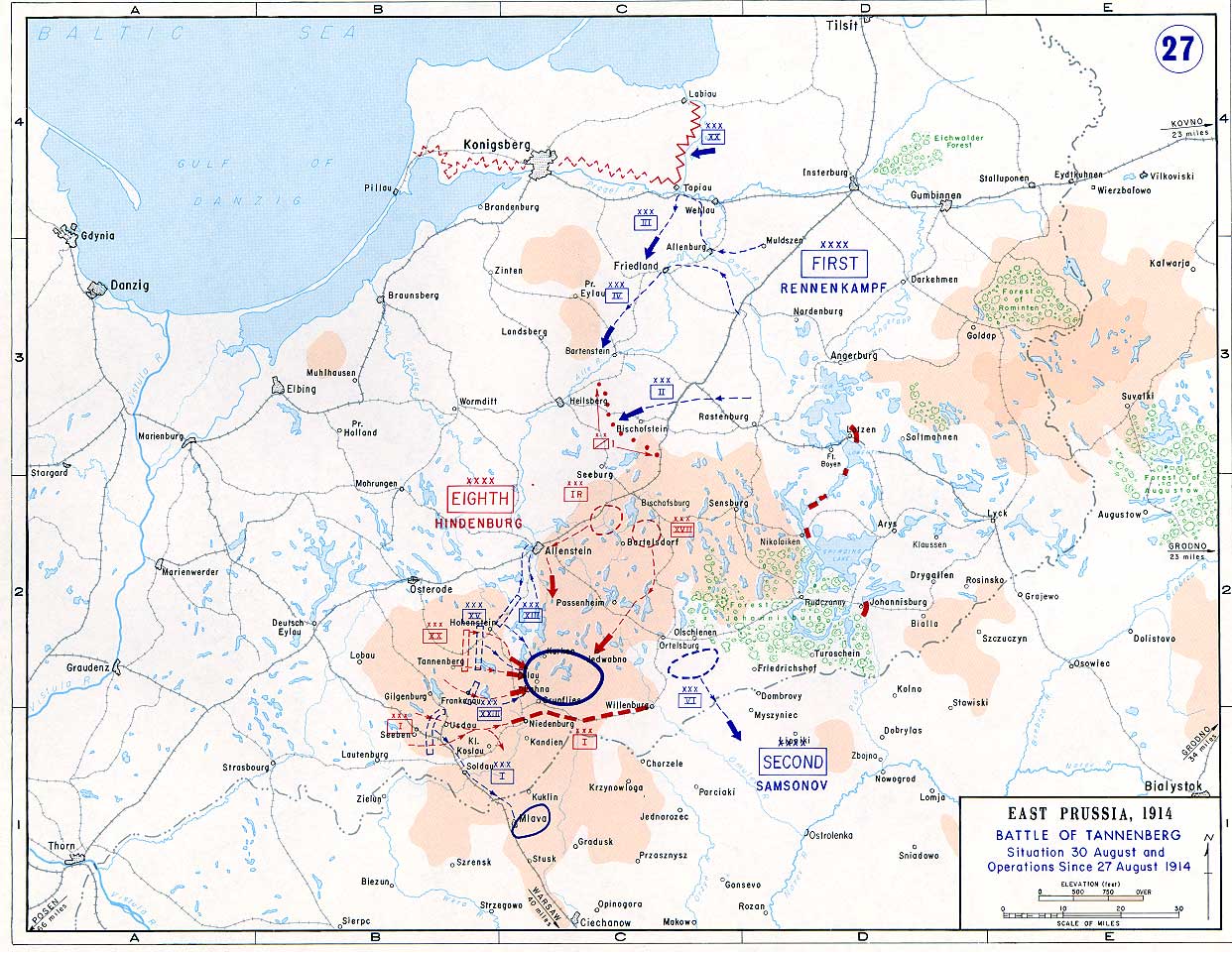

Battle of Tannenberg (1914) in its last phase
- Date
- 1914
- Mapmaker / publisher
- US-Army under www.dean.usma.edu
- Archive
- Wikimedia Commons
- Type
- map
- Original size
- 1,242 × 961 pixels
Public domainsafest
Reason: a US government work (US Army).
Read from: Commons licence category: PD US Army; no CC BY, CC BY-SA, GFDL or deletion tag on the file page; permission field: The picture is public domain..
Credit line
"Battle of Tannenberg (1914) in its last phase" (1914). US-Army under www.dean.usma.edu, via Wikimedia Commons. Public domain. https://commons.wikimedia.org/wiki/File:Tannenberg3008.jpgNeed maps for a whole project? Add Find Any Map to Claude and ask for this one by its id: 22068.
More like this

East Prussia, August 17 – 23, 1914
2003 · Wikimedia Commons

Masurian Lakes Sep1914
c. 1910 · Wikimedia Commons

Eastern Front to September 26, 1914
1914 · Wikimedia Commons

Bitwa pod Tannenbergiem. Położenie na teatrze wojennym w czasie od 28 VIII - 31 VIII 1914.
1914 · Wikimedia Commons
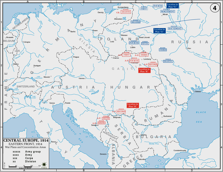
Eastern Front, 1914
1914 · Wikimedia Commons

East Prussia, August 23 – 26, 1914 See Battle of Tannenberg.
1914 · Wikimedia Commons

Bitwa pod Tannenbergiem. Trzeci dzień bitwy 28 VIII 1914.
1914 · Wikimedia Commons

Tannenberg-28-8-1914
September 3, 2005 · Wikimedia Commons