

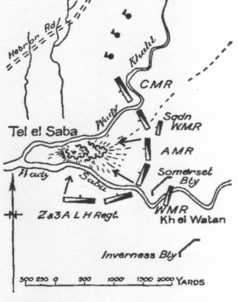
Detail of 4th Light Horse Brigade War Diary Map
- Date
- c. 1917
- Mapmaker / publisher
- 4th Light Horse Brigade
- Archive
- Wikimedia Commons
- Type
- map
- Original size
- 1,783 × 1,125 pixels
Public domain
Reason: public domain: Australia.
This status rests on the map's publication history, as researched by Wikimedia Commons. Check it before commercial use.
Read from: Commons licence category: PD-Australia; no CC BY, CC BY-SA, GFDL or deletion tag on the file page.
Credit line
"Detail of 4th Light Horse Brigade War Diary Map" (c. 1917). 4th Light Horse Brigade, via Wikimedia Commons. Public domain. https://commons.wikimedia.org/wiki/File:4LHBwd3.18.BShebaMapDet.jpegNeed maps for a whole project? Add Find Any Map to Claude and ask for this one by its id: 23001.
More like this

Sketch map of Beersheba charge in 4th Light Horse Brigade War Diary
1918 · Wikimedia Commons
GullettCh23p.390Tel elSaba
1941 · Wikimedia Commons

Sketch Map of Shellal, Tel el Fara and Gamli showing trenches partly built by the Anzac Mounted Division.
1917 · Wikimedia Commons

Powles pp.112-3sit.29.10.17
1922 · Wikimedia Commons

Powles pp.48-9 Magdhaba
1922 · Wikimedia Commons

Powles pp.144-5 Ayun Kara map
1922 · Wikimedia Commons
First Gaza Sketch Map showing movement of Anzac Mounted Division
1917 · Wikimedia Commons

Detail of sketch map showing positions at 14:00 during First Battle of Gaza;Other information: Australian Government document
1917 · Wikimedia Commons