

Das Koenigreich Serwien, 1791
Das Koenigreich Serwien, map of made by in 1791.
- Date
- 1791
- Place
- Serbia
- Archive
- Wikimedia Commons
- Type
- map
- Original size
- 603 × 438 pixels
Public domainsafest
Reason: its maker died more than 100 years ago.
Read from: Commons licence category: PD-old-100-expired; no CC BY, CC BY-SA, GFDL or deletion tag on the file page.
Credit line
"Das Koenigreich Serwien, 1791" (1791). Wikimedia Commons. Public domain. https://commons.wikimedia.org/wiki/File:Das_Koenigreich_Serwien,_1791.jpgNeed maps for a whole project? Add Find Any Map to Claude and ask for this one by its id: 297410.
More like this

Ca. 1738 map of Serbia and Bosnia by Johann Friedrich Oettinger
c. 1738 · Wikimedia Commons

Belgrade
1789 · Wikimedia Commons

Nedićeva Srbija
1952–1978 · Wikimedia Commons
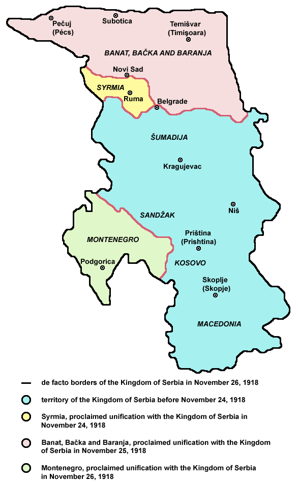
Serbia1918
Wikimedia Commons

Serbia1918 (sr)
Wikimedia Commons

Harta Iozefina a Banatului background 1769-72
1769–1772 · Wikimedia Commons

"Accuratester Plan und Grundriss, vorstellend. gloriöse Victorie. 1717. Belgrad nebst allen in der Belagerung und Haupt=Schlacht merckwürdig vorgefallenen Begebenheite(n). von einem der vornehmsten be
1717 · Wikimedia Commons

official map of the austro-hungarian occupied zone of Serbia during ww1
1916 · Wikimedia Commons