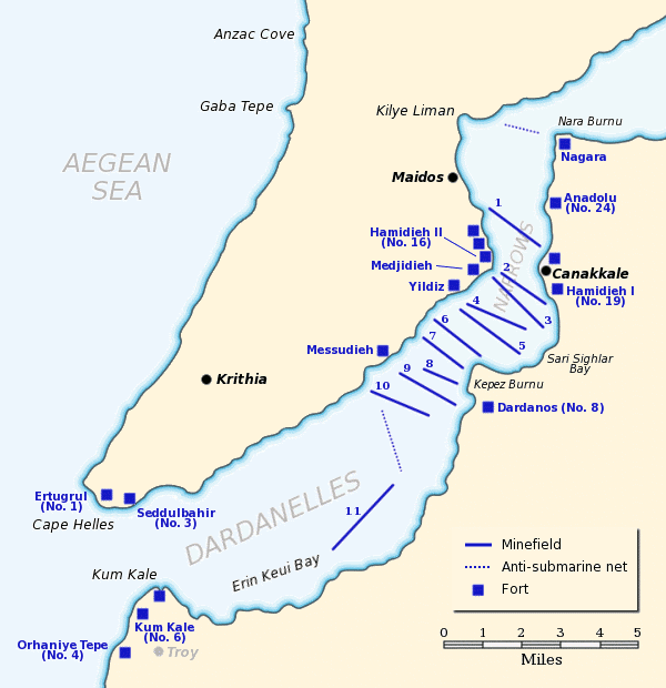

Dardanelles defences 1915
Map of the Dardanelles defences in February and March, 1915. The original lines of naval mines are numbered 1 to 10. The 11th line, laid in Erin Keui Bay by the minelayer Nusrat on 8 March, is numbered 11. The anti-submarine nets are shown as dotted lines. Major forts are indicated with blue boxes and the Turkish name and equivalent British number for the fort is given, if known.
- Date
- June 22, 2005
- Mapmaker / publisher
- Gsl
- Place
- the Dardanelles
- Archive
- Wikimedia Commons
- Type
- map
- Original size
- 600 × 620 pixels
Public domain
Reason: public domain: user.
This status rests on the map's publication history, as researched by Wikimedia Commons. Check it before commercial use.
Read from: Commons licence category: PD-user; no CC BY, CC BY-SA, GFDL or deletion tag on the file page; permission field: Released to public domain.
Credit line
"Dardanelles defences 1915" (June 22, 2005). Gsl, via Wikimedia Commons. Public domain. https://commons.wikimedia.org/wiki/File:Dardanelles_defences_1915.pngNeed maps for a whole project? Add Find Any Map to Claude and ask for this one by its id: 22538.
More like this
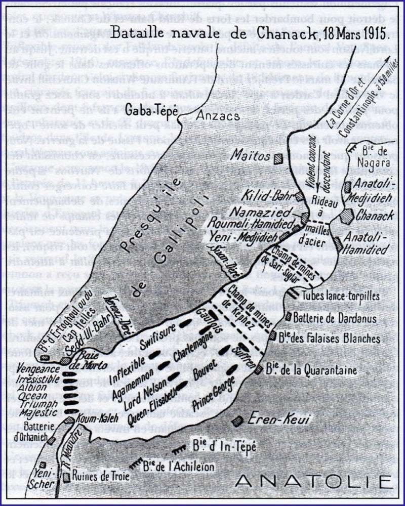
Bataille navale des Dardanelles 1915 carte ancienne
1915–1920 · Wikimedia Commons
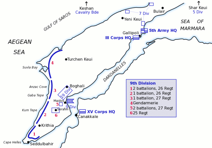
Map of Turkish forces at Gallipoli April 1915
March 12, 2004 · Wikimedia Commons

Battle of Gallipoli - map of Turkish dispositions in April 1915
1915 · Wikimedia Commons

Graphic map of the Dardanelles
1915–2012 · Wikimedia Commons

Air Reconnaissance Map Gallipoli Peninsula April 1915
1915 · Wikimedia Commons

The Dardanelles
Wikimedia Commons

Battle of Gallipoli - map of Turkish dispositions, April 1915
1915 · Wikimedia Commons

Anzac covering force landing April 25 1915
c. 2004 · Wikimedia Commons