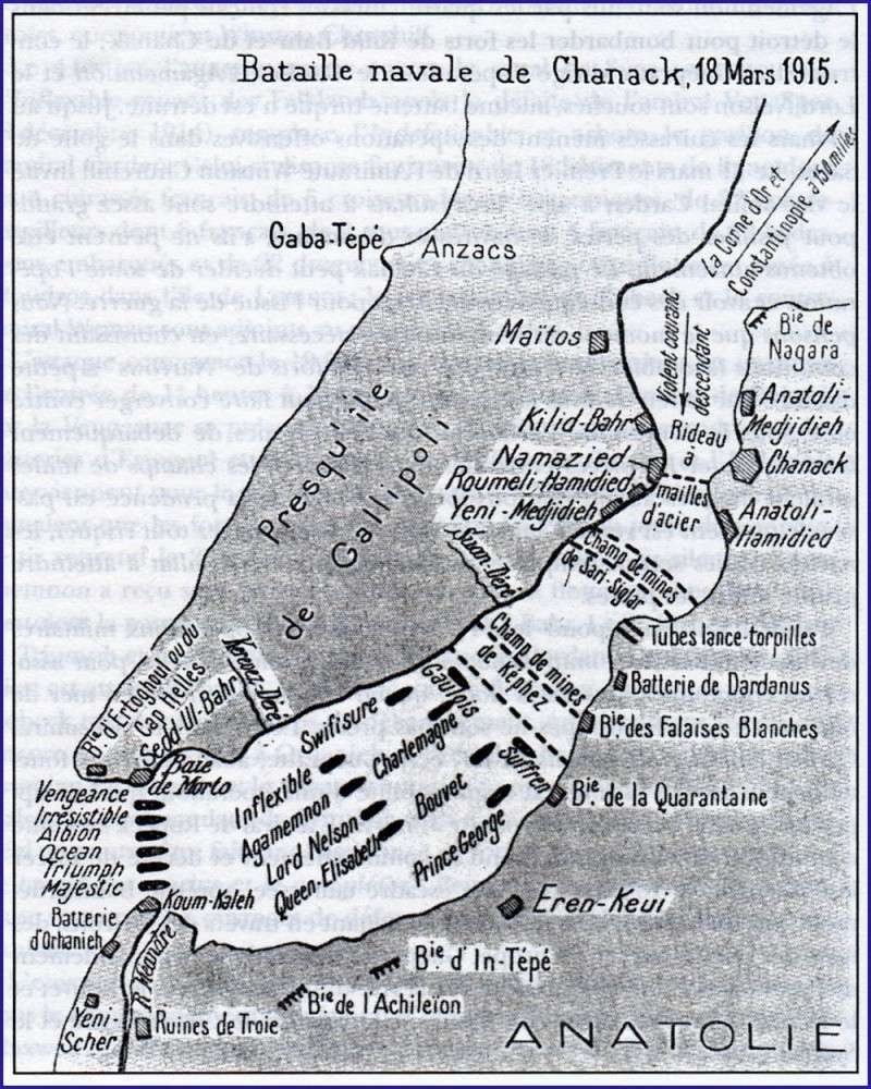

Bataille navale des Dardanelles 1915 carte ancienne
Map of the Franco-British naval attack on the Dardanelles on March 18, 1915 with positions of Allied ships, forts and Turkish minefields. Map without precise date, probably around 1920.
- Date
- 1915–1920
- Archive
- Wikimedia Commons
- Type
- map
- Original size
- 800 × 1,000 pixels
Public domain
Reason: a US government work.
This status rests on the map's publication history, as researched by Wikimedia Commons. Check it before commercial use.
Read from: Commons licence category: PD US; no CC BY, CC BY-SA, GFDL or deletion tag on the file page.
Credit line
"Bataille navale des Dardanelles 1915 carte ancienne" (1915–1920). Wikimedia Commons. Public domain. https://commons.wikimedia.org/wiki/File:Bataille_navale_des_Dardanelles_1915_carte_ancienne.jpgNeed maps for a whole project? Add Find Any Map to Claude and ask for this one by its id: 22554.
More like this

Attaque des Dardanelles plan general publié en 1915
1915 · Wikimedia Commons

1915 French map of the Turkish Straits and the Sea of Marmara
1915 · Wikimedia Commons

The Dardanelles
Wikimedia Commons
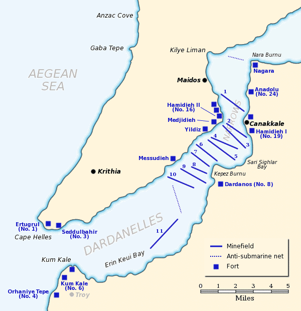
Dardanelles defences 1915
June 22, 2005 · Wikimedia Commons

The "Farmer & Settler" map of Gallipoli War area - 1915
1915 · Wikimedia Commons

1915 bird's eye view map of the Dardanelles
1915 · Wikimedia Commons

1915 - Carte pour suivre les opérations militaires Dardanelles, Mer de Marmara et Bosphore
1915 · Wikimedia Commons

Orographical map of the Dardanelles, reduced from captured Turkish maps
1915 · Wikimedia Commons