

Cheat Mountain
- Date
- September 16, 2005
- Archive
- Wikimedia Commons
- Type
- map
- Original size
- 450 × 450 pixels
Public domain
Reason: public domain: self.
This status rests on the map's publication history, as researched by Wikimedia Commons. Check it before commercial use.
Read from: Commons licence category: PD-self; no CC BY, CC BY-SA, GFDL or deletion tag on the file page.
Credit line
"Cheat Mountain" (September 16, 2005). Wikimedia Commons. Public domain. https://commons.wikimedia.org/wiki/File:Cheat_Mountain.pngNeed maps for a whole project? Add Find Any Map to Claude and ask for this one by its id: 1792.
More like this

Area of the battle of Rich Mountain, July 11-12, 1861.
1861 · Library of Congress
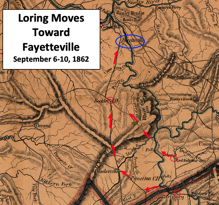
Loring Moves Toward Fayetteville
1864 · Wikimedia Commons

Troop positions at beginning of battle (not to scale)
2024 · Wikimedia Commons

Plate 27-4, South Mountain
1870 · Wikimedia Commons

Pencil sketch of the road from Slaven's Cabin to the top of Cheat Mountain in the area of the battle of Rich Mountain, July 11-12, 1861.
1861 · Library of Congress

Sketch of the area of the battles of Rich Mountain, July 11-12, 1861.
1861 · Library of Congress

Sketch of the Site of the O pe rations of the 10th, 11th, & 12th, July 1861, at Rich Mountain near Beverly, Randolph Co., West Virginia, between the U. S. Forces under Major Gen. Geo. McClellan and the Confederate troops, by Lieut. O. M. poe, U. S. Topl. Engrs.
July 10, 1861 · U.S. National Archives

Cheat Mountain Battlefield West Virginia
February 2, 2010 · Wikimedia Commons