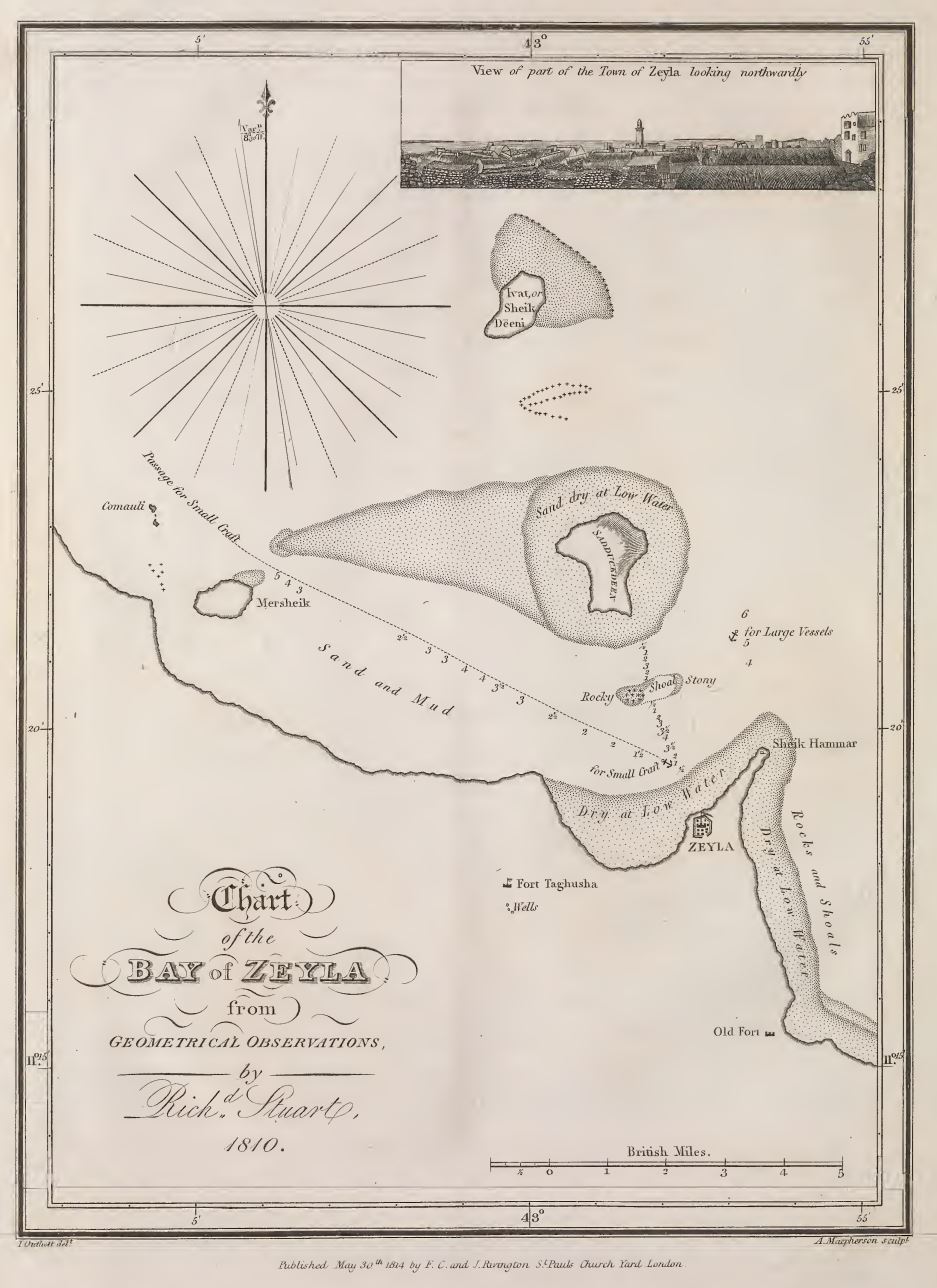

Chart of Zeyla
Plate 35., facing page 475. (per index). Chart of the Bay of Zeyla from geometrical observations by Rich.d Stuart, 1810. Drawn by J. Outhett; Engraved by A. Macpherson. surveyed by Richard Stuart, 1810
- Date
- May 30, 1814
- Mapmaker / publisher
- Salt, Henry (1780 -1827). Drawn by John Outhett, engraved by Alexander Mcpherson, Published by F.C.&J. Rivington, St. Pauls Church Yard, London
- Place
- Somaliland
- Archive
- Wikimedia Commons
- Type
- chart
- Original size
- 937 × 1,288 pixels
Public domainsafest
Reason: its maker died more than 100 years ago.
Read from: Commons licence category: PD-old-100-expired; no CC BY, CC BY-SA, GFDL or deletion tag on the file page.
Credit line
"Chart of Zeyla" (May 30, 1814). Salt, Henry (1780 -1827). Drawn by John Outhett, engraved by Alexander Mcpherson, Published by F.C.&J. Rivington, St. Pauls Church Yard, London, via Wikimedia Commons. Public domain. https://commons.wikimedia.org/wiki/File:Chart_of_Zeyla,_1810.JPGNeed maps for a whole project? Add Find Any Map to Claude and ask for this one by its id: 237204.
More like this

Chart of Amphila Bay
1814 · Plate 10

General chart of the East Coast of Africa
1814 · Plate 2

Chart of the Red Sea, the coast of Abyssinia, from the Straits of Bab-el-Mandeb to Salaka, A.D. 1804-5
1809 · Wikimedia Commons

Chart of the harbour of Mosambique
1814 · Plate 5

Map of Abyssinia and the adjacent districts laid down partly from original Observations taken in the Country and partly compiled from information collected there by Henry Salt,. in 1809 & 1810. The Course of the Nile and parts to the westward of Samen are laid down from Mr. Bruce's Maps. This Map
1814 · Wikimedia Commons

Chart of the Red Sea from Salaka to Suez, 1804-1805
1809 · Wikimedia Commons

A voyage to Abyssinia, and travels into the interior of that country: executed under the orders of the British government, in the years 1809 and 1810: in which are included, an account of the Portuguese settlements on the east coast of Africa, visited in the course of the voyage: a concise narrat
1809 · Wikimedia Commons

Voyages and travels to India, Ceylon, the Red Sea, Abyssinia, and Egypt, in the years 1802, 1803, 1804, 1805, and 1806
1802 · Chart of the Red Sea