

Chart of Amphila Bay
Plate 10
Plate 10., facing p. 146. Chart of Amphila Bay. Surveyed in Dec. 1809 & Jan. 1810 by Henry Salt esq., and Capt. Thos. Weatherhead. Drawn by J. Outhett; Engraved by A. Macpherson. Dedicated to Right Honorable Charles Yorke. Mozambique
- Date
- 1814
- Mapmaker / publisher
- Salt, Henry (1780 -1827). Drawn by John Outhett, engraved by Alexander Mcpherson, Published by F.C.&J. Rivington, St. Pauls Church Yard, London
- Place
- Africa
- Archive
- Wikimedia Commons
- Type
- chart
- Original size
- 1,327 × 966 pixels
Public domainsafest
Reason: its maker died more than 100 years ago.
Read from: Commons licence category: PD-old-100-expired; no CC BY, CC BY-SA, GFDL or deletion tag on the file page.
Credit line
"Chart of Amphila Bay" (1814). Salt, Henry (1780 -1827). Drawn by John Outhett, engraved by Alexander Mcpherson, Published by F.C.&J. Rivington, St. Pauls Church Yard, London, via Wikimedia Commons. Public domain. https://commons.wikimedia.org/wiki/File:Chart_of_Amphila_Bay_(plate_10).jpgNeed maps for a whole project? Add Find Any Map to Claude and ask for this one by its id: 235466.
More like this

General chart of the East Coast of Africa
1814 · Plate 2

Chart of the Red Sea, the coast of Abyssinia, from the Straits of Bab-el-Mandeb to Salaka, A.D. 1804-5
1809 · Wikimedia Commons

Chart of the harbour of Mosambique
1814 · Plate 5
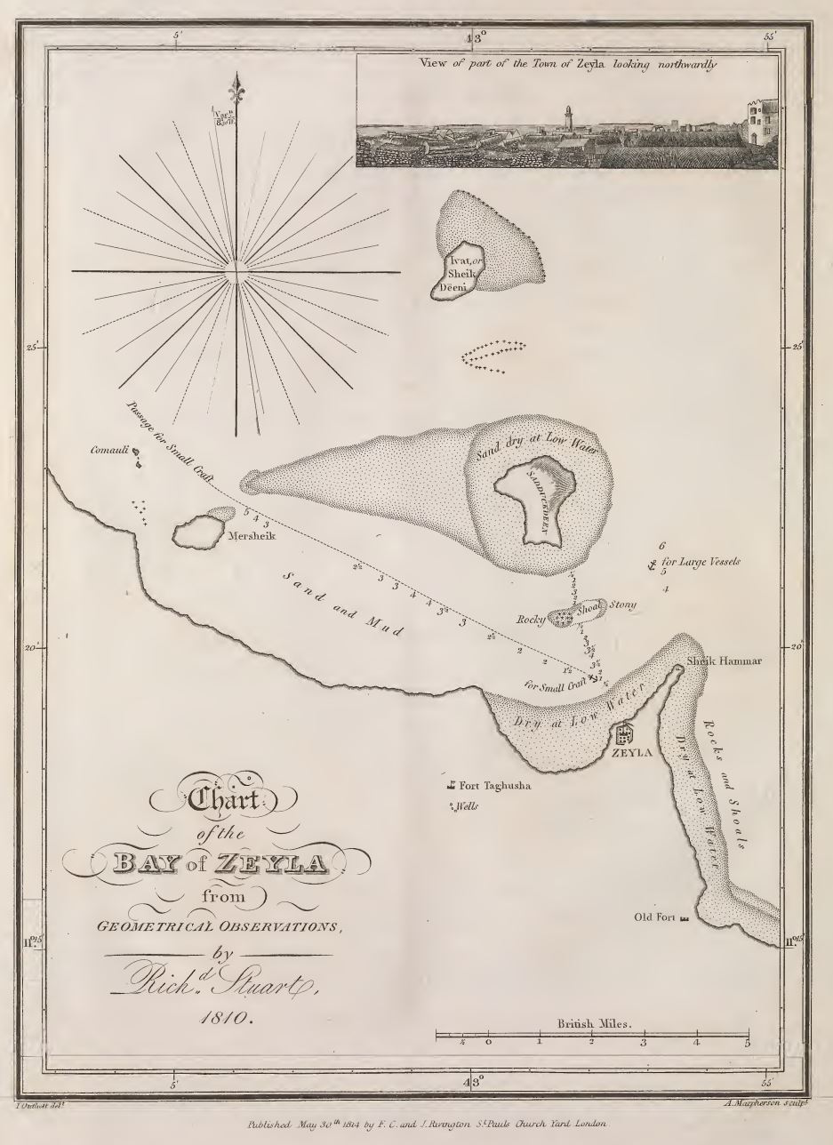
Chart of Zeyla
May 30, 1814 · Wikimedia Commons

Chart of the environs of Valentia Island, pub. 1809
1809 · Wikimedia Commons

Chart of Port Mornington, and the adjacent Islands, pub. 1809
1809 · Wikimedia Commons

Map of Abyssinia and the adjacent districts laid down partly from original Observations taken in the Country and partly compiled from information collected there by Henry Salt,. in 1809 & 1810. The Course of the Nile and parts to the westward of Samen are laid down from Mr. Bruce's Maps. This Map
1814 · Wikimedia Commons

Chart of the Red Sea from Salaka to Suez, 1804-1805
1809 · Wikimedia Commons