
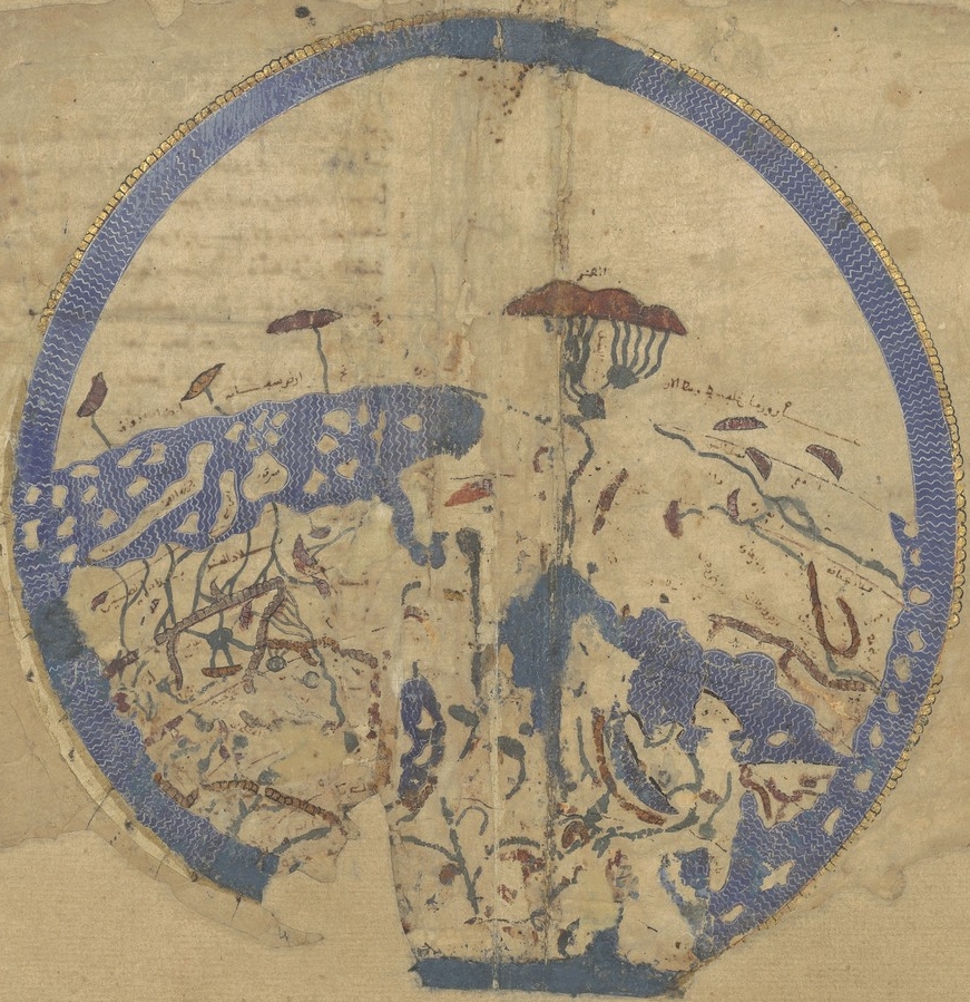
Carte générale du globe tirée de la géographie d'El-Edrisi, milieu du XIIe s. de l'ère vulgaire
General map of the globe taken from the geography of El-Edrisi, mid-12th century of the vulgar era.
- Mapmaker / publisher
- Idrīsī, Muḥammad ibn Muḥammad al-Šarīf Abū ʿAbd Allâh al- (1100?-1165?). Auteur du texte
- Archive
- Wikimedia Commons
- Type
- map
- Sheets
- 2
- Original size
- 37,985 × 15,732 pixels
Public domainsafest
Reason: its US copyright has expired (published before 1931).
Read from: Commons licence category: PD US expired; no CC BY, CC BY-SA, GFDL or deletion tag on the file page.
Credit line
"Carte générale du globe tirée de la géographie d'El-Edrisi, milieu du XIIe s. de l'ère vulgaire". Idrīsī, Muḥammad ibn Muḥammad al-Šarīf Abū ʿAbd Allâh al- (1100?-1165?). Auteur du texte, via Wikimedia Commons. Public domain. https://commons.wikimedia.org/wiki/File:Carte_g%C3%A9n%C3%A9rale_du_globe_tir%C3%A9e_de_la_g%C3%A9ographie_d%27El-Edrisi,_milieu_du_XIIe_s._de_l%27%C3%A8re_vulgaire_-_btv1b100601717.jpgNeed maps for a whole project? Add Find Any Map to Claude and ask for this one by its id: 20910.
All 2 sheets
Each sheet links to its file at the archive; the image link is the full-size scan.


More like this
Idrisi MS BNF Ar 2221 f 3v-4r
1250–1325 · Wikimedia Commons

Carte d'El- Edrisi en 69 feuilles, divisée par climats et sections, manuscrit de la Bibl iothè que Royale (réduction au quart corrigé: 1/5 de la grandeur)
Wikimedia Commons

Tabula Rogeriana 1929 copy by Konrad Miller
1926 · Wikimedia Commons

صورة الأرض. للشريف الإدريسي المتوفي سنة 56 هجري
1951 · Wikimedia Commons

1911 EB Map Fig 16
c. 1911 · Wikimedia Commons

Extrait d'une ancienne carte générale des parties connues du globe insérée dans le Gesta Dei per Francos / gravé par E. Collin
1321–1436 · 2 sheets

Universal Map 2, Al-Idrisi (1100-1165)
Wikimedia Commons

Reproducció d'un mapa d'Edrisi de la part d'Àfrica i Àsia
1895–1930 · Wikimedia Commons