

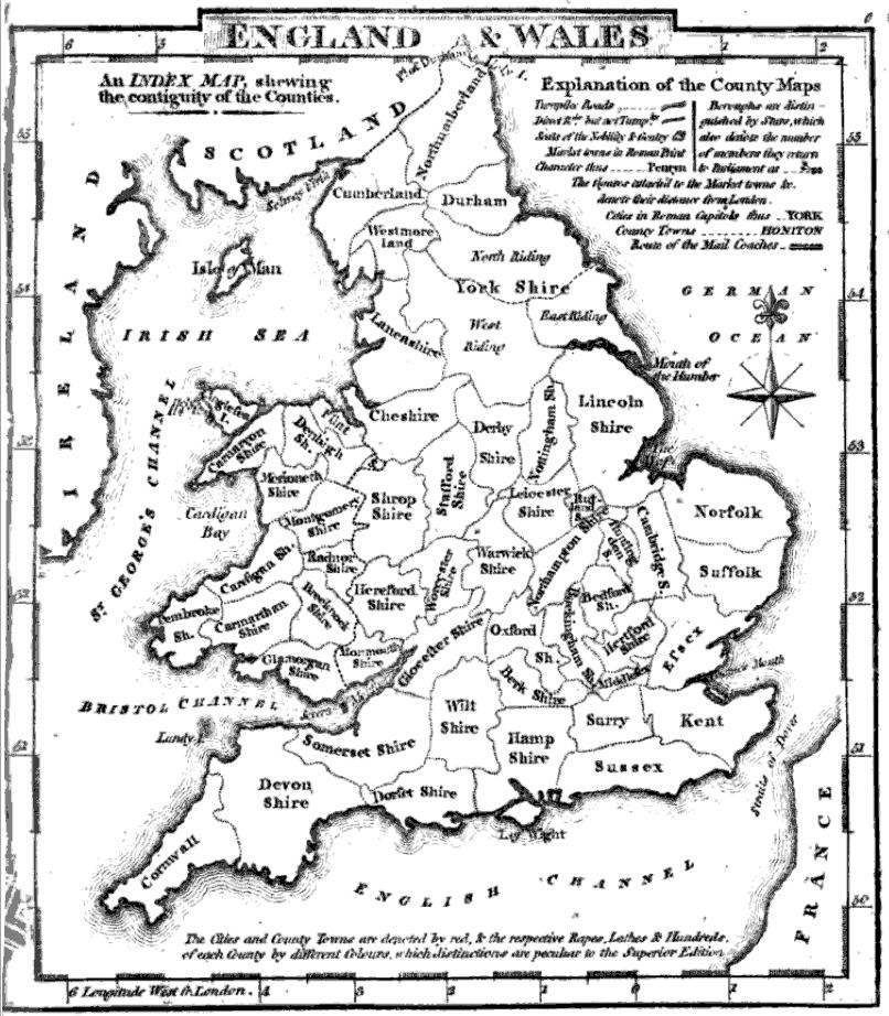
C. 1832 England and Wales (Parliament)
Map of England and Wales circa 1832 CE
- Date
- 1888–1897
- Place
- England and Wales
- Archive
- Wikimedia Commons
- Type
- atlas page
- Original size
- 2,948 × 3,921 pixels
Public domainsafest
Reason: its maker died more than 100 years ago.
Read from: Commons licence category: PD-old-100-expired; no CC BY, CC BY-SA, GFDL or deletion tag on the file page.
Credit line
"C. 1832 England and Wales (Parliament)" (1888–1897). Wikimedia Commons. Public domain. https://commons.wikimedia.org/wiki/File:C._1832_England_and_Wales_(Parliament).jpgNeed maps for a whole project? Add Find Any Map to Claude and ask for this one by its id: 244536.
More like this

C. 1832 England and Wales
c. 1911 · Wikimedia Commons

England wales 1832
1923 · Wikimedia Commons

The Collegiate Atlas: consisting of forty maps of modern geography, embracing all the latest discoveries and changes in boundaries, and eighteen maps of historical geography: with a copious index.
Wikimedia Commons

England and Wales.
1585 · Wikimedia Commons

England 1837
1837 · Wikimedia Commons
County map of England and Wales
1824 · Wikimedia Commons

England and Wales. By Sidney Hall. London, published by Longman, Rees, Orme, Brown & Green, Paternoster Row, May 1828.
1828 · Wikimedia Commons

Hand-Atlas über alle Theile der Erde nach dem neuesten Zustande und über das Weltgebäude
Wikimedia Commons