

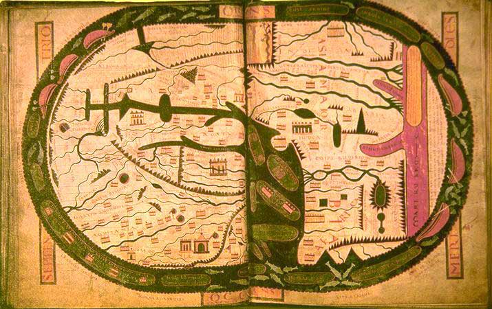
Beatova mapa Saint-Sever
St. Sever world map after Beatus, 1030 A.D. (oriented with East at the top) 37 x 57 cm
- Mapmaker / publisher
- The link with maps is public
- Archive
- Wikimedia Commons
- Type
- map
- Original size
- 715 × 450 pixels
Public domain
Reason: its maker died more than 100 years ago, and a faithful scan of a flat work adds no new copyright.
This status rests on the map's publication history, as researched by Wikimedia Commons. Check it before commercial use.
Read from: Commons licence category: PD-Art (PD-old-100); no CC BY, CC BY-SA, GFDL or deletion tag on the file page.
Credit line
"Beatova mapa Saint-Sever". The link with maps is public, via Wikimedia Commons. Public domain. https://commons.wikimedia.org/wiki/File:Beatova_mapa_Saint-Sever.jpgNeed maps for a whole project? Add Find Any Map to Claude and ask for this one by its id: 139586.
More like this
World map.
Wikimedia Commons

WesternEurope BeatusOsma
Wikimedia Commons

Mapamundi del Beato de Gerona f. 54v-55r
Wikimedia Commons

Mappemonde-XIe-siecle medium
Wikimedia Commons

The Valcavado Beatus.
Wikimedia Commons

Mapa-múndi do Beato de Valcavado
Wikimedia Commons

Silos Apocalypse - BL Add MS 11695 f. 039v-40 - Map
Wikimedia Commons

Seu de urgell beatus
Wikimedia Commons