

Battle of Droop Mountain map
This is a United States War Department map of the Droop Mountain battlefield, including positions of the Union and Confederate armies. The Battle occurred on November 6, 1863, with the Union force led by William W. Averell defeating a Confederate Force led by John Echols. The map's orientation is somewhat "upside down", as Hillsborough is actually northeast of Droop Mountain.
- Date
- 1890
- Mapmaker / publisher
- United States War Department (much of the work was done by Robert N. Scott, Joseph W. Kirkley, and Fred C. Ainsworth
- Archive
- Library of Congress (via Wikimedia Commons)
- Type
- map
- Original size
- 828 × 944 pixels
Public domainsafest
Reason: a US government work.
Read from: Commons licence category: PD US Government; no CC BY, CC BY-SA, GFDL or deletion tag on the file page.
Credit line
"Battle of Droop Mountain map" (1890). United States War Department (much of the work was done by Robert N. Scott, Joseph W. Kirkley, and Fred C. Ainsworth. Library of Congress, Geography and Map Division, via Wikimedia Commons. Public domain. https://commons.wikimedia.org/wiki/File:Battle_of_Droop_Mountain_map.pngNeed maps for a whole project? Add Find Any Map to Claude and ask for this one by its id: 933.
More like this

Map of the battle field of Carnifex Ferry, Gauley River, West Va., Sept. 10th 1861. United States forces commanded by Brig. Gen. W. S. Rosecrans
1876 · Library of Congress

Map of the battle field of Carnifex Ferry, Gauley River, West Va., Sept. 10th 1861 - United States forces commanded by Brig. Gen. W.S. Rosecrans.
1876 · Library of Congress

Battle of Cross Keys map
1895 · Wikimedia Commons

In the American Civil War's Third Battle of Winchester that occurred on September 19, 1864, Union cavalry (including Averell's 2nd Division) attacked from the north.
1873 · Library of Congress

Averells Return May 1864 V2
1861 · Library of Congress

Map of the Rich Mountain battlefield, W. Va. July 11-12, 1861.
1861 · Library of Congress
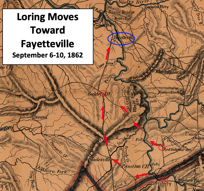
Loring Moves Toward Fayetteville
1864 · Wikimedia Commons

Map of the Battle of Gettysburg, 1863
1863 · Wikimedia Commons