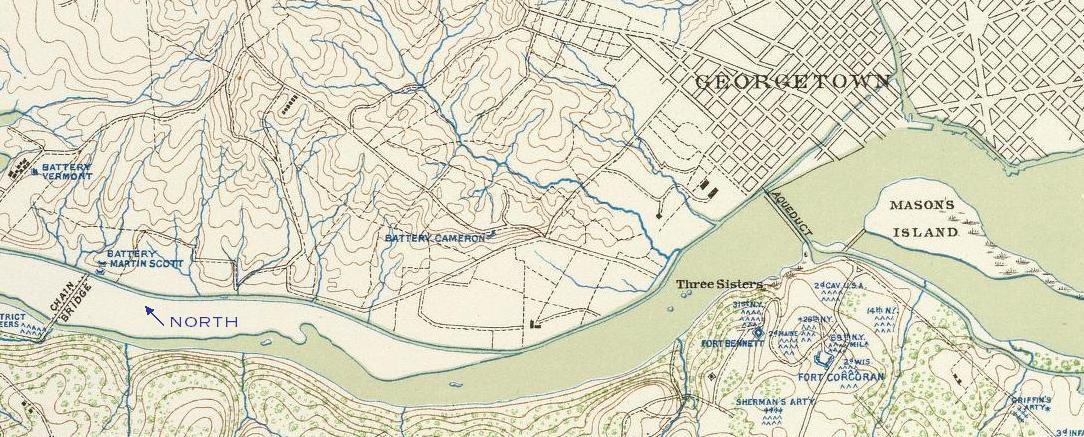

Battery Cameron
Map showing location of Battery Cameron, Battery Martin Scott, and Battery Vermont relative to the Chain Bridge and Aqueduct Bridge. Note the absence of Battery Kemble to the north. This image is public domain, due to its age. Full title: Defenses of Washington. Map of the ground of occupation and defense of the Division of the U.S. Army in Virginia in command of Brig. Gen. Irvin McDowell. U.S. Coast Survey, A.D. Bache, Supdt. Topographical survey by the party in charge of H.L. Whiting, Asst., U.S.C.S. Field work executed during parts of June and July 1861, by F.W. Dorr and C. Rockwell U.S.C.S. (with) Sketch of Paducah, Ky. and vicinity by Captain John Rziha, 19th U.S. Infantry. (with) Sketch of the battle-field of Logan's Cross-roads, Ky. U.S. forces under the command of Brig. Gen. George H. Thomas. Forces of the enemy commanded by General G.B. Crittenden, Jan. 19, 1862. Drawn under the direction of Capt. Michler. copied by A. Kilp. Sketch of the enemy's fortified position at and opposite Mill Springs, Ky., to which he retreated after his defeat at Logan's Cross-roads by the U.S. forces under Brig. Gen. George H. Thomas, Jan. 19, 1862. compiled. by Edward Ruger. drawn
- Date
- 1895
- Mapmaker / publisher
- Dorr, F. W.; Rockwell, Cleveland; United States. War Department; Whiting, H. L
- Place
- the Civil War Defenses of Washington, D.C.
- Archive
- Wikimedia Commons
- Type
- map
- Original size
- 1,084 × 437 pixels
Public domainsafest
Reason: a US government work (US Army).
Read from: Commons licence category: PD US Army; no CC BY, CC BY-SA, GFDL or deletion tag on the file page.
Credit line
"Battery Cameron" (1895). Dorr, F. W.; Rockwell, Cleveland; United States. War Department; Whiting, H. L, via Wikimedia Commons. Public domain. https://commons.wikimedia.org/wiki/File:Battery_Cameron.jpgNeed maps for a whole project? Add Find Any Map to Claude and ask for this one by its id: 297.
More like this

Defenses of Washington. Maps 1 through 12 accompanying General Barnard's report.
1865 · P. 3 of 12

Sketch showing the triangulation of the principal Defenses of the District of Columbia executed under the general direction of Col. J. N. Macomb, U. S. Topl. Engrs., by Charles A. Schott, Asst., U. S. Coast Survey, January to May 1863.
August 18, 1863 · U.S. National Archives

Fort Craig VA Map
1865 · 2 sheets

N E Virginia forts and roads, detail of Washington2
1865 · Library of Congress

Map of the defences of Washington.
1865 · Library of Congress

Surveys of the military defences, vicinity of Washington,DC
1862 · Library of Congress

Map of the fortifications within the District of Columbia.
1862 · Library of Congress

Map of fortifications and defenses of Washington.
1865 · Library of Congress