
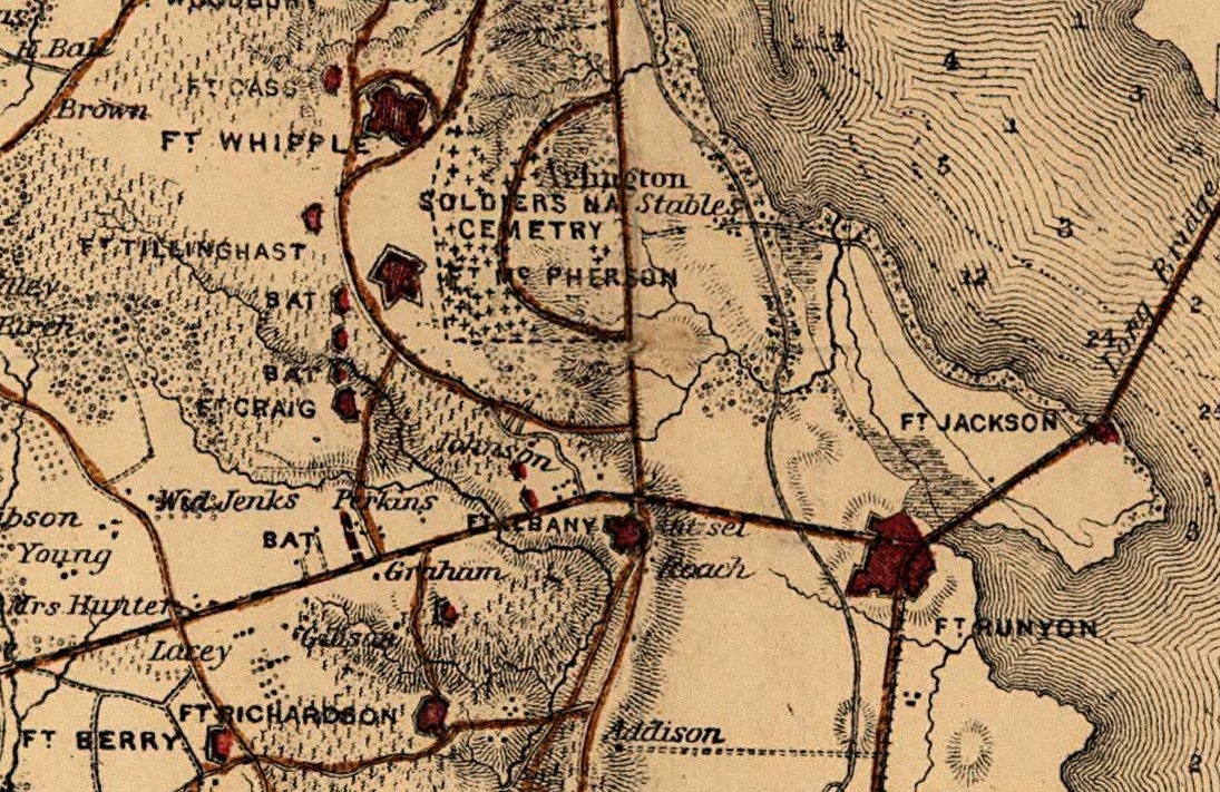
Fort Craig VA Map
Map of American Civil War defenses of Washington, D.C. in 1865. US Government document, War Department (1865).
- Date
- 1865
- Mapmaker / publisher
- Map by Engineer Bureau, U.S. War Department, Via
- Place
- the Civil War Defenses of Washington, D.C.
- Archive
- Wikimedia Commons
- Type
- map
- Sheets
- 2
- Original size
- 668 × 436 pixels
Public domainsafest
Reason: a US government work.
Read from: Commons licence category: PD US Government; no CC BY, CC BY-SA, GFDL or deletion tag on the file page.
Credit line
"Fort Craig VA Map" (1865). Map by Engineer Bureau, U.S. War Department, Via, via Wikimedia Commons. Public domain. https://commons.wikimedia.org/wiki/File:Fort_Craig_VA_Map_(cropped).jpgNeed maps for a whole project? Add Find Any Map to Claude and ask for this one by its id: 301.
All 2 sheets
Each sheet links to its file at the archive; the image link is the full-size scan.


More like this

N E Virginia Forts and Roads 1865
1865 · Library of Congress

N E Virginia forts and roads, detail of Washington2
1865 · Library of Congress

Surveys of the military defences, vicinity of Washington,DC
1862 · Library of Congress

1865 Washington
1865 · Library of Congress

Map of the environs of Washington - compiled from Boschkes' map of the District of Columbia and from surveys of the U.S. Coast Survey showing the line of the defences of Washington as constructed
1865 · Library of Congress

Map of fortifications and defenses of Washington.
1865 · Library of Congress

Defenses of Washington, extract of military map of N.E. Virginia - showing forts and roads
1865 · Library of Congress

Environs of Washington Prepared from original Surveys in the Engineer Department. ca. 1864-66.
1864–1866 · 8 sheets