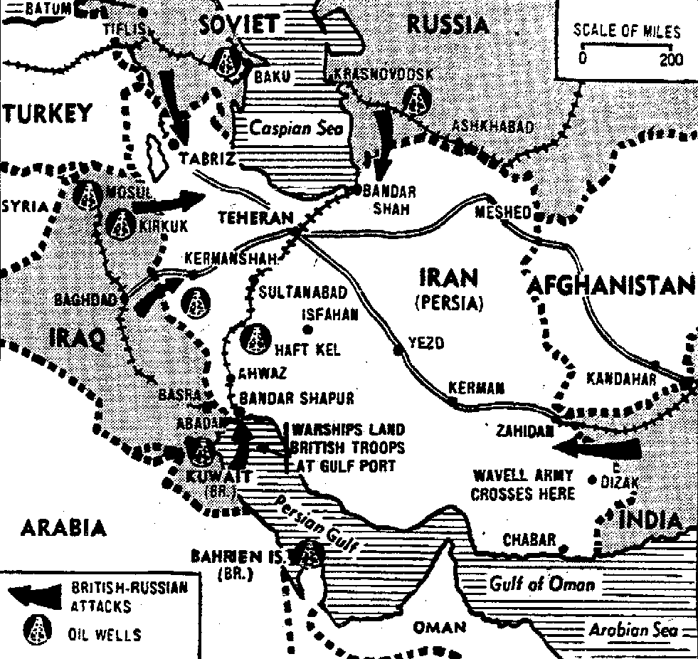

Allied Forces Sweep on in Iran
Map legend shows origins and direction of Russian and British attacks as the two nations invade Iran to protect oil fields from sabotage by German agents who they claim have infiltrated there
- Date
- August 26, 1941
- Mapmaker / publisher
- NEA Telephoto
- Place
- Iran
- Archive
- Wikimedia Commons
- Type
- map
- Original size
- 981 × 926 pixels
Public domainsafest
Reason: published in the US without a copyright notice (before 1978).
Read from: Commons licence category: PD US no notice; no CC BY, CC BY-SA, GFDL or deletion tag on the file page.
Credit line
"Allied Forces Sweep on in Iran" (August 26, 1941). NEA Telephoto, via Wikimedia Commons. Public domain. https://commons.wikimedia.org/wiki/File:Allied_Forces_Sweep_on_in_Iran.pngNeed maps for a whole project? Add Find Any Map to Claude and ask for this one by its id: 24063.
More like this

Middle East.
1918 · Library of Congress

Iran oyobi Afuganisutan - sanbyakuman-bun no ichi zu.
1941 · Library of Congress

Map of Principal Russian-Aid Routes
1952 · Wikimedia Commons

Iran oyobi Afuganisutan - sanbyakuman-bun no ichi zu.
1941 · Library of Congress

Newsmap - The Middle East
April 1, 1946 · Wikimedia Commons

U.S.S.R. - Iran Frontier Area East of the Caspian Sea
U.S. National Archives

Map. Battle area on the eastern front
July 12, 1943 · Wikimedia Commons

Newsmap -- Monday, September 14, 1942
1942 · Wikimedia Commons